|
 Carrizo Plain National Monument
N 35° 15.668 W 119° 55.878
11S E 233327 N 3905942
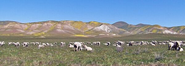
California's largest native grassland
Waymark Code: WM3C5N
Location: California, United States
Date Posted: 03/13/2008
Views: 86
Most National Monuments in the United States are managed by the National Park Service and can be logged as waymarks under U.S. National Parks. However, a number of National Monuments are managed by other agencies and are not accepted by the above mentioned waymark group.
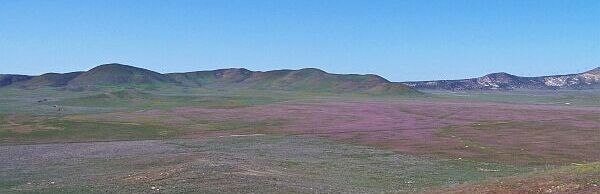
During his last days in office, President Bill Clinton upgraded the status of five wilderness areas managed by the Bureau of Land Management by declaring them National Monuments. One of them is the Carrizo Plain, the largest remaining undisturbed native grassland in California. Although now called a National Monument, it is still a wilderness area under the jurisdiction of the Bureau of Land Management.
|

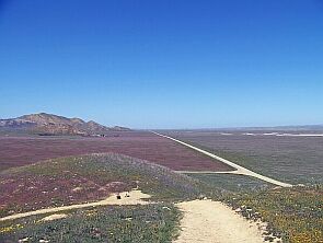 Soda Lake Road Soda Lake Road |
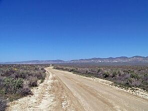 Elkhorn Road Elkhorn Road
|
As can be seen in the pictures above, most of Carrizo Plain is really just that: a plain, crossed by two forty-mile-long dirt roads. But there are a number of special features, and during our visit in Spring 2008, we stopped at some of them.
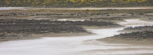
Soda Lake
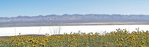
The 3,000 acre large Soda Lake is one of the largest undisturbed alkali wetlands in California. It is the remain of a prehistoric sea and stays dry most of the year, being covered by a thick layer of sodium sulfate and carbonate salts.
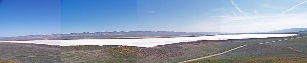 To show the full size of Soda Lake, we had to put four pictured together. Click on the links below to see the individual pictures.
|
|
The best place to see Soda Lake is the top of overlook hill at N35° 14.391’ W119° 54.411’.
|
|
The southern shore of Soda Lake (the one nearest to Soda Lake Road) is protected and off limits, but Simmler Road crosses the lake and allows access to the salt flats.
|
Wallace Creek
Wallace Creek is a small stream draining into Soda Lake that remains dry most of the year. It drains perpendicular to the San Andreas Fault and the creek bed is currently offset by 400 feet due to the movement of the fault.
|
San Andreas Fault
Half a mile from the junction of Simmler and Elkhorn Road is the trailhead to Wallace Creak Trail which leads directly to two other older creek beds along the San Andreas Fault. This is one of the best places to learn about the fault. For more information, read the plaque at the trailhead or check out the Wallace Creek website.
|
|
The old riverbeds of Wallace Creek – now a visible part of the San Andreas Fault.
|
 One foot on the American Plate One foot on the American Plate
|
 Holding the plates together Holding the plates together
|
 One foot on the Pacific Plate One foot on the Pacific Plate
| | |
|
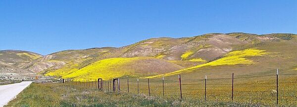
Wildflowers
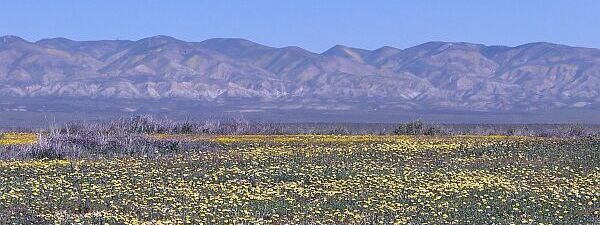
Like anywhere in Southern California, spring is a great time to see desert wildflowers!
|
More Plain
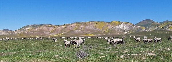
Not much more to say - it really is a large plain.
|
| |
A word of caution:
This place can get pretty hot! It also can be very windy and dusty. This is not a National Park with park rangers, service stations and telephones at every corner. It is largely undeveloped land, the roads are unpaved, and if your tire flattens, you are on your own. Be prepared; carry food, water and a first aid kit. Watch out for rattlesnakes and don’t disturb the wildlife!
|
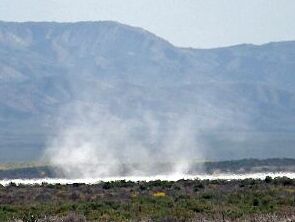 Nature-made dust devil on Soda Lake Nature-made dust devil on Soda Lake |
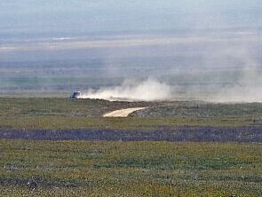 Man-made dust devil on Elkhorn Road Man-made dust devil on Elkhorn Road
|
|
Another Word of Advise:
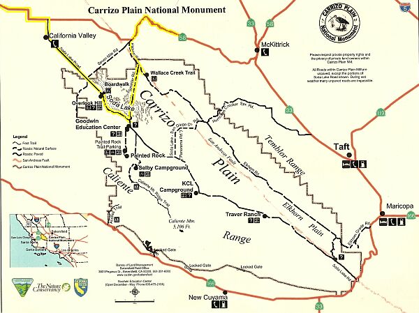
Because of the road conditions, you will NOT be able to cover the entire area in one day! As shown in the map (outlined in yellow) we only touched to northernmost part of the plain and even that little part (10 miles of dirt road and one mile hike) took about four hours!
|
| |
Estimated size of the public land (in regional measurement standard: hectares, acres, kms, etc.): 250,000 acres

Is there a trail system?: Yes
If there is a trail system, please describe length, terrain, etc.:
80 miles of dirt roads and 10 miles of trails
What points of interest are there?:
Soda Lake with Overlook Hill, Petroglyphs at Painted Rock, San Andreas Fault at Wallace Creek
What activities are available?:
camping, hiking, birdwatching
Hours of accessibility?: Anytime
List of known hazards (cliffs, snakes, poison plants, etc.):
rattlesnakes, heat, dust
Dogs Allowed?: Yes
Is a permit/fee required?: No
If a permit/fee is required please describe in detail how to get one, how much, etc.:
None Required.
Please supply the website of the land if available: [Web Link]
|
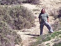
Visit Instructions:
Visitors are encouraged to supply a picture of either themselves or their GPS at the trailhead and/or signage of the public access lands - describe your experience there and what you saw - tell us why other folks should come visit!