
Devil’s Punchbowl - Pearblossom, CA
N 34° 24.835 W 117° 51.524
11S E 421083 N 3808386
The Devil’s Punchbowl is a unique 1,310 acre geological area where visitors can hike through a deep canyon of spectacular sedimentary rock formations.
Waymark Code: WMHCN8
Location: California, United States
Date Posted: 06/24/2013
Views: 14
Devil's Punchbowl Park

Devil's Punchbowl, elevation 4,750 ft (1450 m), is a tilted sandstone formation in Los Angeles County, near Pearblossom, California. Short trails within the park showcase its geologic features along the Punchbowl and San Andreas Faults.
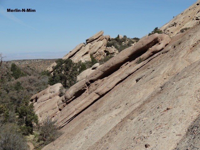
The peculiar uptilted rock formations are layers of sedimentary rocks formed long ago by water depositing sand and rocks in horizontal layers. Later they were squeezed into their present, steeply tilted form by ongoing uplift action along the Punchbowl and Pinyon Faults and by pressures along the San Andreas Fault.
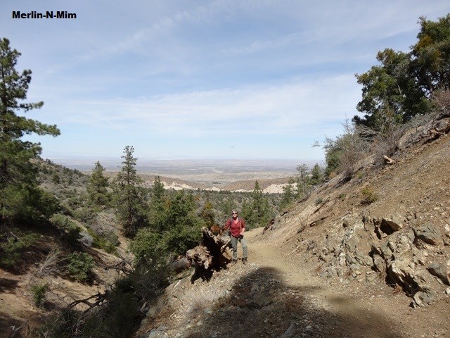
The mountain peaks above the park are 8,000 feet in elevation, compared to the park's Nature Center at 4,740 feet above sea level. The Punchbowl Canyon is 300 feet deep at the vista point. There are connections to longer trails leading to the high country.
There is no entry fee to visit the park.
Address:
28000 Devil's Punchbowl Rd. Pearblossom CA 93553
Park Hours:
Sunrise - Sunset
Visitor Center Hours:
Monday CLOSED
Tuesday - Sunday 9 am - 5 pm
There is no overnight camping in the Devil's Punchbowl, but there are nearby Forest Service campgrounds.
References:
Devil's Punchbowl Website:
Park Website
Wikipedia:
Link