|
 Wallace Creek Trail to the San Andreas Fault
N 35° 16.051 W 119° 49.608
11S E 242857 N 3906374
One of the best places to study the San Andreas Fault
Waymark Code: WM3GXC
Location: California, United States
Date Posted: 04/05/2008
Views: 88

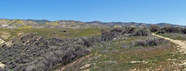
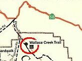
In the north of Carrizo Plain National Monument, half a mile from the junction of Simmler and Elkhorn Road is the trailhead to Wallace Creek Trail which leads directly to an old creek bed along the San Andreas Fault. This is one of the best places to learn about this remarkable geological feature.
|
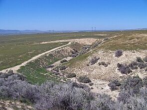
As shown in this picture, there are two sharp bends in this dry river bed. This is where the San Andreas Fault crosses the river, dividing the Pacific Plate (to your left) from the North American Plate (to your right). For the last 4,000 years, since this river bed has formed, the Pacific Plate has been moving north 1.3 inches each year, causing this very visible bend. |
|
Signs along the trail explain the geological features.
For more information on the San Andreas Fault, check out the Wallace Creek website.
|
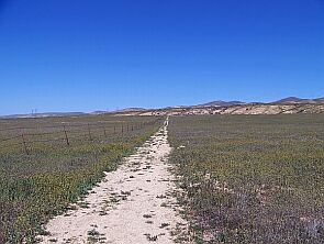 Beginning of the trail Beginning of the trail |
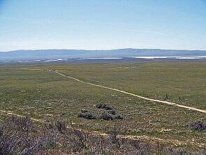 Looking back from the top of the trail Looking back from the top of the trail
|
The trail is less than half a mile long, so the hike really isn’t a problem. Getting there, however, is. Carizzo Plain is crossed by two dirt roads, be prepared to get dirty and take precautionary measures (spare wheel, water etc.). The shortest way to get there is Elkhorn Road off hwy 58.
Click on the map for a larger picture. |
|
At the San Andreas Fault
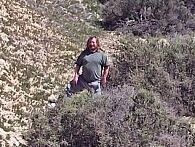 One foot on the American Plate One foot on the American Plate |
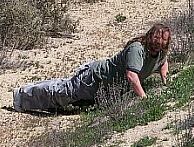 Holding the plates together Holding the plates together |
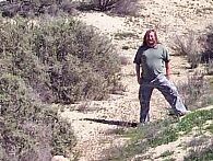 One foot on the Pacific Plate One foot on the Pacific Plate
|
Picture location 1: N 35° 16.051 W 119° 49.608

Picture Location 2: N 35° 16.265 W 119° 49.601
Picture Location 3: Not Listed
|
Visit Instructions:
To log a waymark you must post at least one original picture (preferably with yourself in it) showing the main feature or attraction of this walk/hike.
No picture means no proof which means No Post!
|