
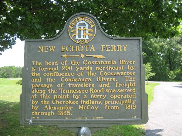
New Echota Ferry
N 34° 32.468 W 084° 54.492
16S E 691955 N 3824145
Cherokee Indians ran a ferry here.
Waymark Code: WMD12
Location: Georgia, United States
Date Posted: 05/19/2006
Views: 31
The head of the Oostanaula River is formed 200 yards northeast by the confluence of the Coosawattee and the Conasauga Rivers. The passage of travelers and freight along the Tennessee Road was served at this point by a ferry operated by the Cherokee Indians, principally by alexander McCoy from 1819 through 1835.
Type of Marker: Other

Marker #: 064-31
Date: 1962
Sponsor: Georgia Historical Commission
|
Visit Instructions:
Take a picture of the marker, yourself at the marker, your gps at the marker, or anything specific to the text on the marker. And don't forget to enjoy your visit.