 The Place:
Oliver, British Columbia, Canada
Regional Area: Okanagan-Similkameen
Location: South Okanagan Valley in the Southern Interior of British Columbia
Governed by: Town of Oliver, Regional District of Okanagan-Similkameen and the Osoyoos Indian Band
Municipal Hall location: 6150 Main Street
First Surveyed: 1921
Incorporated: 1945
Elevation: 1,017 feet (310 metres)
Population: 4,928 (2016)
Climate: Semi Arid
Known as: Canada's Wine Capital
Visit Oliver via Waymarking
 The Person:
Who was John Oliver?
John Oliver first and foremost was affectionately known as "Honest John". John Oliver's vision for the Okanagan Valley transformed it from an arid unproductive area, its potential untapped until in 1919.
John Oliver was born in Hartington, England July 31, 1856, the family moved Ontario in 1870, and moved to BC in 1877 and took up farming in Delta.
John Oliver was raised in a rural farming community though he loved the land, he had higher expectations to enter politics.
After serving in local politics he was elected to the BC legislature in 1900, and appointed Minister of Agriculture and Railways.
With the death of the current Premier, Harlan Brewster in 1918, John Oliver became the Province of British Columbia's 19th Premier, serving until his death on August 17, 1927.
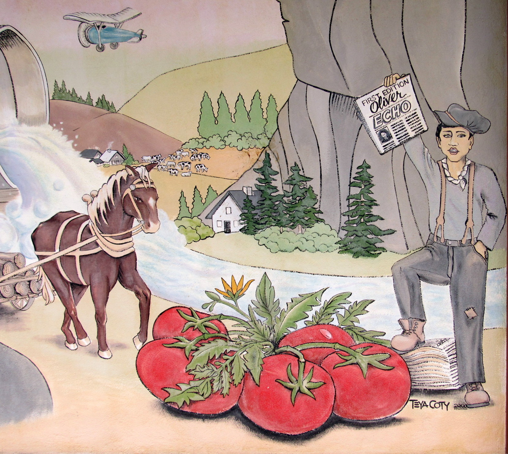
"Following the First World War, BC’s premier, known as “Honest” John Oliver, envisioned an irrigation canal, which would bring this dry Sonora Desert region to life. The South Okanagan Lands Project was born, creating jobs and long term opportunities for veterans returning from World War I. The original townsite of Oliver was surveyed in 1921. Completed in 1923, the concrete irrigation canal (locally known as “the ditch”) soon transformed this desert region into lush orchards and farms."
Source: Oliver
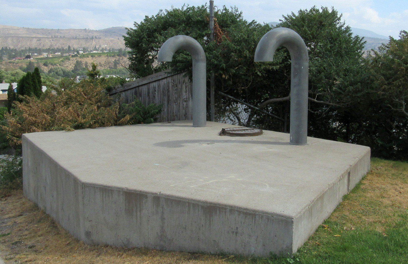
"The Ditch"
"The Ditch: The BC legislature paid $350,000 for 22,000 acres of land in the Okanagan region from McIntyre Bluff to the US border. Premier Oliver recognized the great agricultural potential in the region; but as the Okanagan is Canada’s only desert area, he needed to get water to the future farms and gardens. Thus began the South Okanagan Lands Project (SOLP).
The project consisted of a 25-mile long gravity-fed pipe and canal system constructed from cement, wooden siphons and flumes. Construction began in 1918 and ran until 1925. Many side industries including logging, sawmills, and engineering camps grew up to support the project. Oliver survives as a lasting monument to this immense undertaking."
Source: Oliver Heritage Walking Tour #14
The life size statue of John Oliver, created by local artist Letta Shores, was placed in April 2007.
The Place:
Oliver, British Columbia, Canada
Recently moving to Oliver in June 2020, the community is friendly and welcoming. The first time I visited Oliver, in April, I recall heading north from Osoyoos with all the apple trees in bloom, I remembered how beautiful it was. I knew then, I was home.
On December 31, 2020 the Town of Oliver will celebrate its 75th year of incorporation.
Nestled in the beautiful south Okanagan, Oliver can proudly call itself the Canada's Wine Capital, offering more than 40 of British Columbia's internationally recognized wineries.
Oliver: Canada's Wine Capital appear on both welcome signs. Oliver is a small community with approximately 5,000 residents drawing tourists from around the world. Though Oliver is primarily an agricultural area with an abundance of orchards, and fields of vegetables, it is the local wine industry that has boost Oliver's economy. Most of the local wineries offer tours and of course wine tasting. There are bus tours that offer a variety of options throughout the Okanagan Valley.
It is interesting to note that Oliver Municipal Hall is home in what was South Okanagan Lands Project office.
The current elected officials are:
Martin Johansen - Mayor
Aimee Grice - Councillor
David Mattes - Councillor
Larry Schwartzenberger - Councillor
Petra Veintimilla - Councillor
Tuc-El-Nuit Lake