The Caldera de Taburientes impressive landscapes have always attracted thousands of
tourists. A good choice for visiting Caldera de Taburiente is starting at the
Visitor Center in El Paso. The cords leads you to this center. The finest view
over the caldera is from Pico
Bejenado (1854m), Roques
de Los Muchachos (2426m) or La Cumbrecita N 28° 41.835 W 017° 51.415.
You can drive in your car right to Roques de Los Muchachos and La Cumbrecita,
but you have to walk to Pico Bejenado.
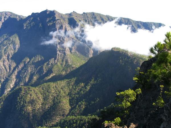
La Combrecita is in the middle of the picture. Here is a parking
area and from here several trails leads you further in the Caldera de Taburiente or to the top of Pico Bejenado from where you have the
best view over the caldera. This picture is taken form the top of Pico Bejenado.
Caldera de Taburiente is one of the biggest craters in the world, 28 km in circumference, 10 km across the widest part and 1,500 m deep.
Inside stands Idafe Rock (see picture), where the Benahoaritas came here to praise their God, Abora. The surrounding mountains rise to 2426 m and are often snowcapped in winter.
The interior of the Caldera is home to towering pines, ferns, birds, geological formations and crystal clear springs which meet at a place known as Dos Aguas. This water is used for agriculture and household purposes. There are no roads inside the park, so if you wish to visit, you must do so on foot. If you want to stay overnight, there is a campsite, but a permit must be obtained in
advance.
If you vant to go inside the caldera, you can either follow trails from La
Combrecia or drive your car to the parkingarea in the floor of the Barranco de
Las Angustias, and from here jeep taxi to Los Brecitos. From here you have a
long track back to your car, but its woth the effort. 12,5km and the decent is
1000m. You can of course just walk in the caldera from the parking area, but the
walk fra La Brecitos is highly recommended, if you are fit and a good walker.
Remember to bring water and food for the whole days walk, you can't buy anything
in the caldera. Notice that the road down to the floor of the barranco is 6km
and very bumpy. I have done it, but not in my own car! :-)
Caldera de Taburiente Visitor Center near El Paso is clearly marked and situated on the LP 2 road midway between Santa Cruz and Los Llanos
- right next to the Cumbrecita turn-off.. The centre has wheelchair access, and
numerous exhibitions, audiovisual rooms, a botanic garden, and a book and video
libray. Of course you can also obtain information, maps, guides and leaflets.
And camping permits for the National Park.
Hours of Operation for the Visitor Center:
Opening hours: Mo-Fri: 09,30 - 13,30h / 16,00 - 19,00h
Sat: 10,00 - 13,00h / 16,00 - 19,00h
Sun-bank holidays: 10,00- 13,00h
Read more here: West Canaries Tourism Guide - La Palma Caldera.