|
 NIAGARA FALLS - Waterfalls ~ Ontario - CANADA. Posted by:  Jake39 Jake39
N 43° 04.708 W 079° 04.575
17T E 656604 N 4771324
This is the 'Mother' of all 'Waterfalls' divided by the border between the 'Province of Ontario' and the 'State of New York' - It is made..up of 3 separate falls known as 'Horseshoe Falls' - 'American Falls' and 'Bridal Veil Falls'
Waymark Code: WM4RP
Location: Ontario, Canada
Date Posted: 12/10/2005
Views: 335
Click for a 5 minute aerial view by a Quad-Copter Camera.

The Falls drop about 170 feet (52 m), although the American Falls have a clear drop of only 70 feet (21 m) before reaching a jumble of fallen rocks which were deposited by a massive rock slide in 1954.
The larger Canadian Falls are about 2,600 feet (792 m) wide, while the American Falls are 1,060 feet (323 m) wide. The volume of water approaching the Falls during peak flow season is 202,000 ft³/s (5,720 m³/s).1,2
During the summer months, when maximum diversion of water for hydroelectric power occurs, 100,000 ft³/s (2,832 m³/s) of water actually traverses the Falls, some 90% of which goes over the Horseshoe Falls. This volume is further halved at night, when most of the diversion to hydroelectric facilities occur.

The 'American Falls'-The 'Bridal Veil Falls' and the 'Maid of the Mist' boat at Niagara Falls
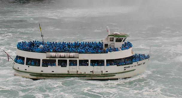
See me on the upper deck? I am in blue rain gear up front! 
A close-up of the falls by 'fussiebears3'.
A "Visited" only, will be deleted. Please include your best photo with your message.
Type: Plunge

Parking Coordinates: N 43° 04.704 W 079° 04.824
Watercourse: Niagara River
Waterfall Height: 170
Seasonality: Perennial
Seasons of Best Flow: From: 04/01/2015 To: 10/31/2015
Viewpoint: Top
Path Up and Down: Partial
Walk Behind: Partially
|
|