|
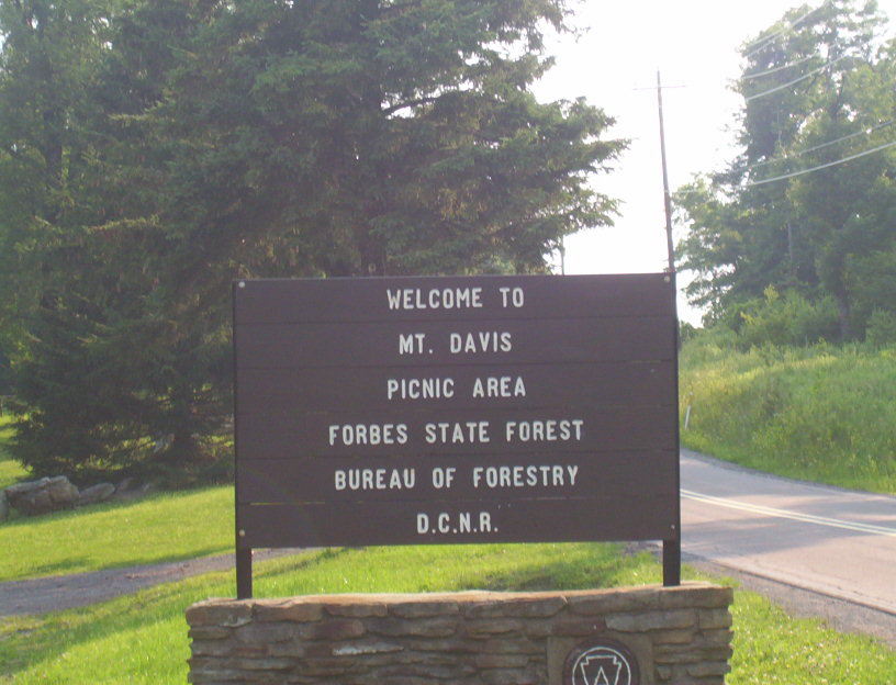
 Mount Davis Picnic Area - Forbes State Forest - Salisbury, Pennsylvania
N 39° 47.656 W 079° 09.997
17S E 656970 N 4406531
The Mount Davis Picnic Area is located on the Mount Davis Road (S.R. 2004) ontop Mount Davis in Elk Lick Township, Somerset County, Pennsylvania
Waymark Code: WM58WE
Location: Pennsylvania, United States
Date Posted: 11/29/2008
Views: 12
Mount Davis Picnic Area - Forbes State Forest
 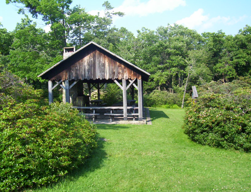 
The Mount Davis Picnic Area, part of the Forbes State Forest, was constructed during the Civilian Conservation Corps (CCC) era of the late 1930's and early 1940's, before World War II. The CCC constructed things at the picnic area like a latrine, picnic shelter, and grills. Presently the picnic shelter is the only item from the CCC Days that remains. It should also be noted that the CCC had a camp on the other side of the mountain that is used as the State Forest's Negro Mountain Division Maintenance Shed. The CCC also constructed roads on state forest land as well as constructing hiking trails and planting trees and such on deforested land.
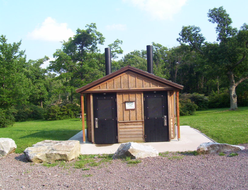
Today at the Picnic Area, there are rustic restrooms, the CCC Picnic Pavilion, picnic tables charcoal grills, and handicap-accessible picnic table and surface constructed as an Eagle Scout Project.
Beyond the picnic area, there is a one-mile hiking trail that connects to the high-point observation tower area, at 3,213 Mount Davis is the Highest Point in the state of Pennsylvania.
Estimated size of the public land (in regional measurement standard: hectares, acres, kms, etc.): 7 Acres

Is there a trail system?: Yes
If there is a trail system, please describe length, terrain, etc.:
From here the High Point Trail connects from here to the Highest Point Observation area on fairly level terrain
What points of interest are there?:
There is a picnic pavilion, rustic restrooms, picnic tables and charcoal grills.
What activities are available?:
Picnicking
Hours of accessibility?: Sunrise-Sunset
List of known hazards (cliffs, snakes, poison plants, etc.):
There is known high bear activity, therefore it is a carry-in - carry out area and trash is not collected.
Snow is know to be in this area at least once each month of the year.
Dogs Allowed?: Yes
Is a permit/fee required?: No
Please supply the website of the land if available: [Web Link]
If a permit/fee is required please describe in detail how to get one, how much, etc.: Not listed
|
Visit Instructions:
Visitors are encouraged to supply a picture of either themselves or their GPS at the trailhead and/or signage of the public access lands - describe your experience there and what you saw - tell us why other folks should come visit!
|