Shack above village Lozzi, Corsica, France
Posted by: Groundspeak Premium Member Rikitan
N 42° 21.557 E 008° 58.306
32T E 497675 N 4689669
This lonely cabin we've seen after approx. 1 hour of hike from village Lozzi, Corsica, up to highest mountain of the island - Monte Cinto. Building looks like abandon mountain challet, but it could serve as a shelter for shepherds in the past.
Waymark Code: WMJ3VD
Location: Corse, France
Date Posted: 09/19/2013
Published By:Groundspeak Premium Member lumbricus
Views: 8

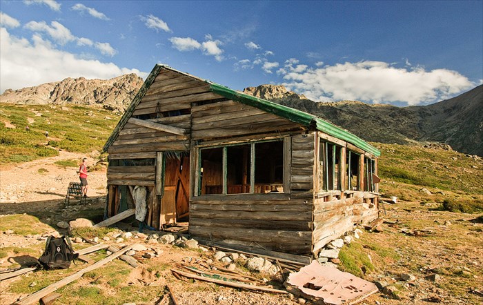
This lonely cabin we've seen after approx. 1 hour of hike from L'Armone camping above village of Lozzi, Corsica, France up to highest mountain of the island - Monte Cinto. Building looks like abandon mountain challet, but it could serve as a shelter for shepherds in the past.

In topographical maps of Corsica we have, it is marked as a "bar", located at the end of the "road" with "parkinglot". Road itself is currently in bad condition, it is rather rocky path, passable only in all-terrain vehicles.

There's not much left in the building, basically just a garbage, bits and pieces of furniture and so. However, roof is still in good condition, so cabin can serve as a fair place to stay over night or bad weather. I don't have other information about this shack.
Visit Instructions:
Please provide a photo of you and/or your GPS at the site.
Search for...
Geocaching.com Google Map
Google Maps
MapQuest
Bing Maps
Nearest Waymarks
Nearest Unoccupied Buildings, Shacks, and Cabins
Nearest Geocaches
Create a scavenger hunt using this waymark as the center point
Recent Visits/Logs:
There are no logs for this waymark yet.