|
 Clerke Nature Reserve - Vernon, BC Posted by:  T0SHEA T0SHEA
N 50° 16.049 W 119° 17.063
11U E 337202 N 5570867
This is a little natural area surrounded by a relatively new residential neighbourhood in the west central area of Vernon.
Waymark Code: WMND3N
Location: British Columbia, Canada
Date Posted: 02/17/2015
Views: 3
This one acre natural area is for hikers/walkers only with a network of trails that meander through this beautiful area. In the area near the roadside is a rocky hillside graced with native grasses, shrubs and wildflowers that enhances it rustic appeal.
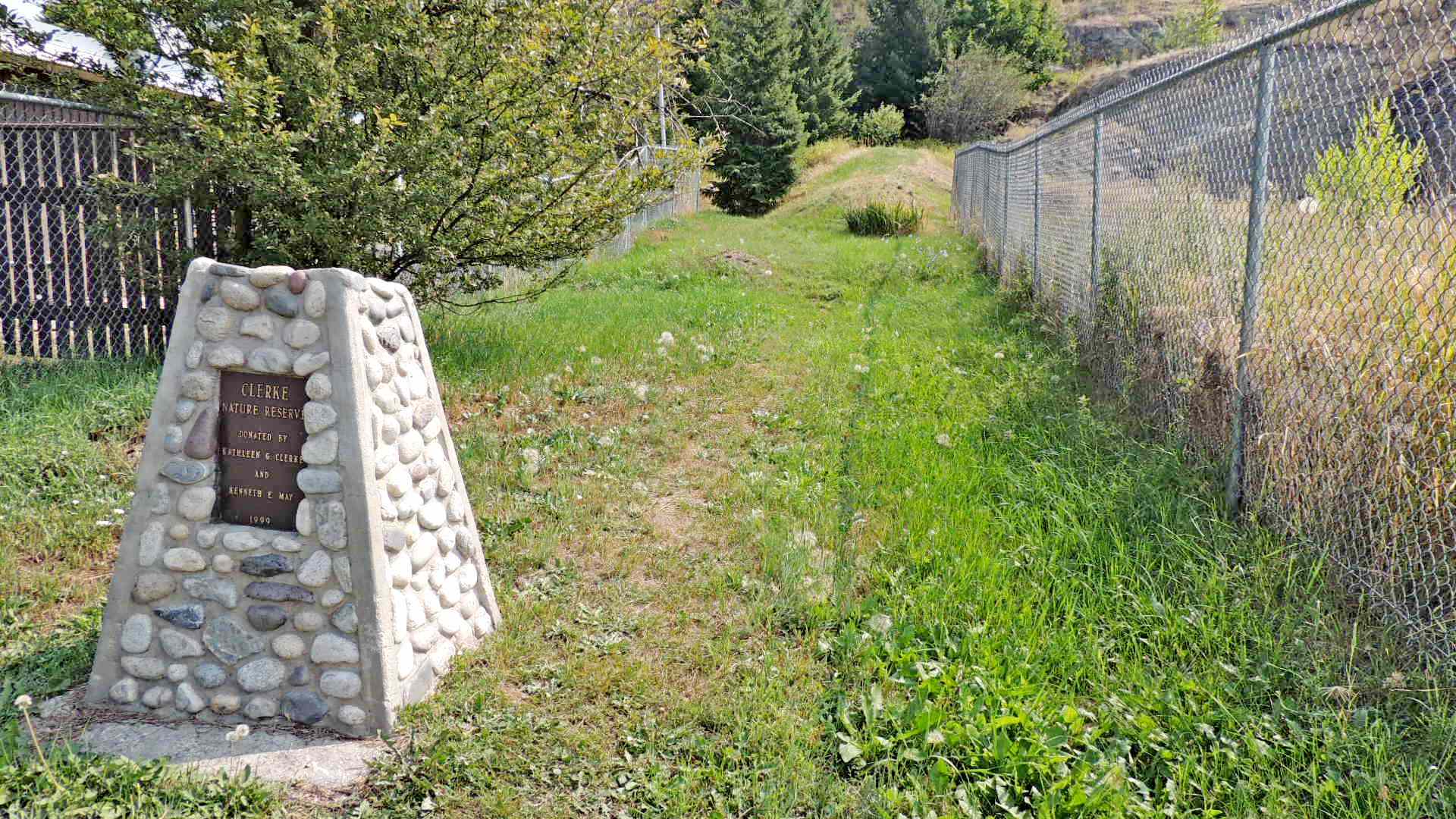
There is a small cairn made of natural river rock, most likely collected from the area. There is a plaque attached to the cairn that reads as follows;
Clerke
Nature Reserve
Donated By
Kathleen G. Clerke
and
Kenneth E. May
1999
Below is a good summary of the park, what it is, how it came to be and what the future may hold for it.
Clerke Nature Reserve
The Clerke Nature Reserve is at 3497 Alexis Park Drive in Vernon. It was donated to the Regional District of the Okanagan by Kenneth May and the late Kathleen May (née Clerke), a member of a prominent Vernon family, and is to be maintained in its natural state for the enjoyment of residents of the North Okanagan and visitors. It was dedicated at a public ceremony on October 8, 2004.
The Regional District granted a covenant to the North Okanagan Parks & Natural Areas Trust to monitor the condition and use of the land and ensure that that it remains in its natural state. It is on a steep west facing slope with rock outcroppings that contains native plants and some shrubs and trees. This one acre parcel provides a natural green space in the middle of Vernon. It is to the west of Becker Park and can be accessed off Alexis Park Drive and 36th Avenue. While separated by a few metres from Becker Park, it is expected that a connection eventually will be provided, to allow access to another natural area with walking trails, at the edge of downtown Vernon.
In January 2014 under a reorganization of parks within the Regional District, ownership of the land transferred to the City of Vernon, with the terms of the conservation covenant remaining unchanged.
From NOPNAT
Estimated size of the public land (in regional measurement standard: hectares, acres, kms, etc.): 1 Acre

Is there a trail system?: No
What points of interest are there?:
rock outcroppings, indigenous plants and trees
What activities are available?:
None, pedestrian access only
Hours of accessibility?: Dawn to dusk
List of known hazards (cliffs, snakes, poison plants, etc.):
Steep slopes on rock outcrops
Dogs Allowed?: No
Is a permit/fee required?: No
Please supply the website of the land if available: [Web Link]
If there is a trail system, please describe length, terrain, etc.: Not listed
If a permit/fee is required please describe in detail how to get one, how much, etc.: Not listed
|
Visit Instructions:
Visitors are encouraged to supply a picture of either themselves or their GPS at the trailhead and/or signage of the public access lands - describe your experience there and what you saw - tell us why other folks should come visit!
Recent Visits/Logs:
| There are no logs for this waymark yet. |
|
|
|
|