BM 78T2 - Oliver, BC
Posted by:  T0SHEA
N 49° 10.960 W 119° 33.045
11U E 314123 N 5450894
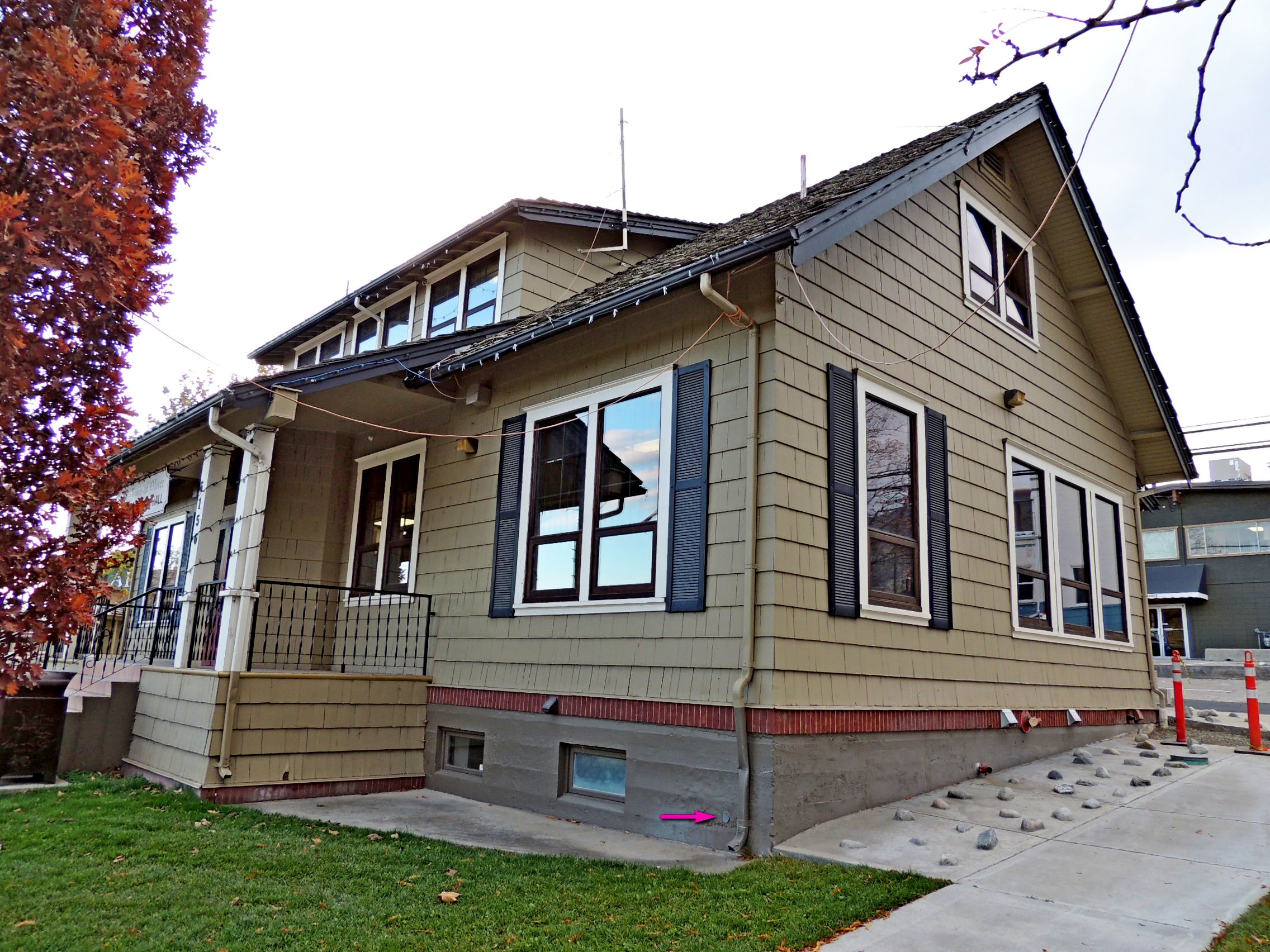
78T2, full designation 46C78T2, is monumented in the front wall of the municipal building on the west side of Main Street between School Avenue and Fairview Road.
Waymark Code: WMQ341
Location: British Columbia, Canada
Date Posted: 12/10/2015
Views: 7
78T2 is on the lower right corner of the building when viewed from the front, or the northeast corner, less than a foot above the sidewalk and just left (south) of the downspout.
Name	Province			NTS map sheet	Unique Number
78T2	British Columbia	082E04			46C78T2
Oliver
Provincial government building at southwest corner of intersection of main street and cross street to station, tablet in front concrete foundation wall, at northeast corner of building.
From
NRCAN