
10-24 McClellanville
Posted by:  mikemtn
N 33° 05.989 W 079° 28.139
17S E 642866 N 3663395
Located SE corner of US 17 and Road 1189 McClellanville, South Carolina. Erected by St. James, Santee, Historical Society-1955.
Waymark Code: WMTGV
Location: South Carolina, United States
Date Posted: 10/07/2006
Views: 33
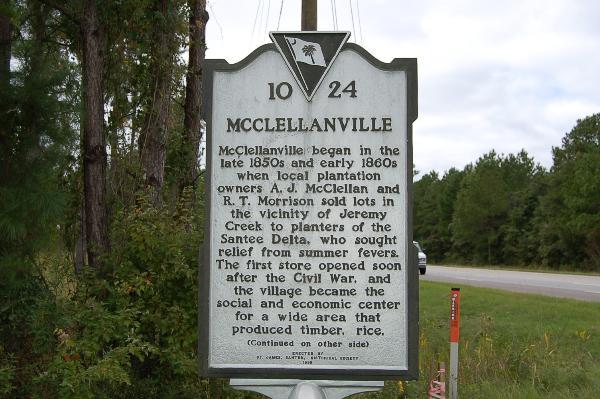
Text front: McClellanville began in the late 1860's when local plantation owners A.J. McClellan and R.T. Morrison sold lots in the vicinity of Jeremy Creek to planters of the Santee Delta, who sought relief from summer fevers. The first store opened soon after the Civil War, and the village became the social and economic center for a wide area that produced timber, rice,
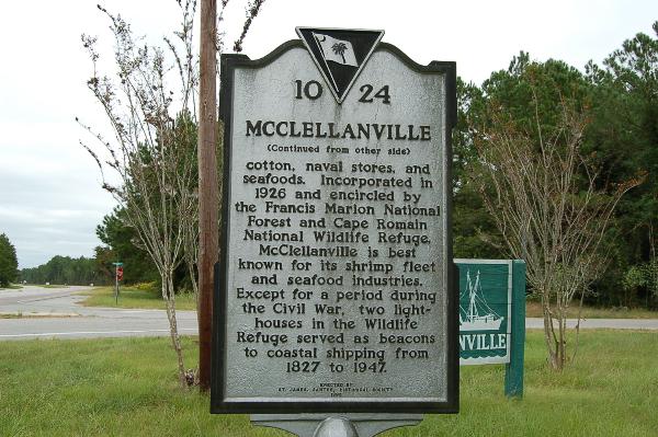
Text reverse: cotton, naval stores, and seafoods. Incorporated in 1926 and encircled by the Francis Marion National Forest and Cape Romain National Wildlife Refuge, McClellanville is best known for its shrimp fleet and seafood industries. Except for a period during the Civil War, two light-houses in the Wildlife Refuge served as beacons to coastal shipping from 1827 to 1947.
