|
The Admiral's Arch
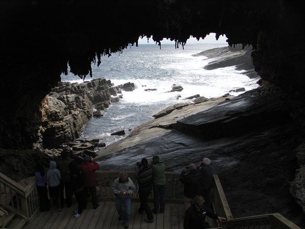
The Admiral’s Arch is a remnant of the ancient cave that was broken by ocean waves and transformed into a natural bridge. Stalactites are still hanging off the top of the arch as the evidence of its unusual history. The arch presents a geological significance and designated as a geological monument. (http://www.yktravelphoto.com/places/the-admirals-arch-kangaroo-island/1479/en/)
Admiral’s Arch is not your usual water-carved natural bridge. It is, in fact, an ancient cave that has simply been broken into by the waves. Stalactites still cling to the remnant of the cave’s roof. The weather was brooding, which made less than ideal conditions for photography, but seemed to match the dark, haunting, ruined aspect of the exposed cave. (http://waltzingaustralia.wordpress.com/page/14/?archives-list=1)
(picture taken by the owner)
How is Admiral's Arch built?
-
Caves form in cliffs as a result of direct sea action. The sea smash's the headlands weakening the rocks. The force of the waves start to create small cracks in the cliff (a) and debris starts to come away. Once the first small crack is formed, the pressure of the sea hitting the cliff becomes greater as trapped air is forced into these cracks making them wider.
-
Over time the cracks also become exposed to other forms of erosion such as freezing and thawing during winter, expanding the cracks further and the decay of algae growing within the cracks. This process continues until the crack forms a small hole (b). The sea gradually erodes the inside of the hole and creates further cracks creating a small cave.
|
-
Eventually the small cave becomes larger. As the pressure of forced air into the small cave, direct sea action, freezing-thawing and erosion by biological processes continues, the cave becomes wider. At headlands it continues until it breakes through the other side, creating an arch (c).
-
As the arch widens the pressure of weight from the top of the arch increases. This pressure causes small cracks to appear which then weaken the top of the arch, widening the the cracks further. Erosion contributes to the weakening of this 'bridge'. Eventually the arch collapses (d).
-
As the sea continues to erode the sides of the stack, it becomes top heavy and starts to collapse. The top also becomes weathered by rain and wind until eventually the stack becomes a stump (e). Sometimes the stump disappears.
(Taken from: http://www.ukfossils.co.uk/guides/Caves-Arches-Stacks-Stumps.htm)
The steps of the process described above can be seen in the Admiral's Arch (c) and the Casuarina Islets (e).
|