|
 Quoddy Head State Park - Lubec, ME Posted by:  T0SHEA T0SHEA
N 44° 48.856 W 066° 57.074
19T E 661995 N 4964359
When standing at the given coordinates looking east, one sees the easternmost point in the US. Nearby is this historical marker, one of three at the site.
Waymark Code: WMV3KQ
Location: Maine, United States
Date Posted: 02/18/2017
Views: 4
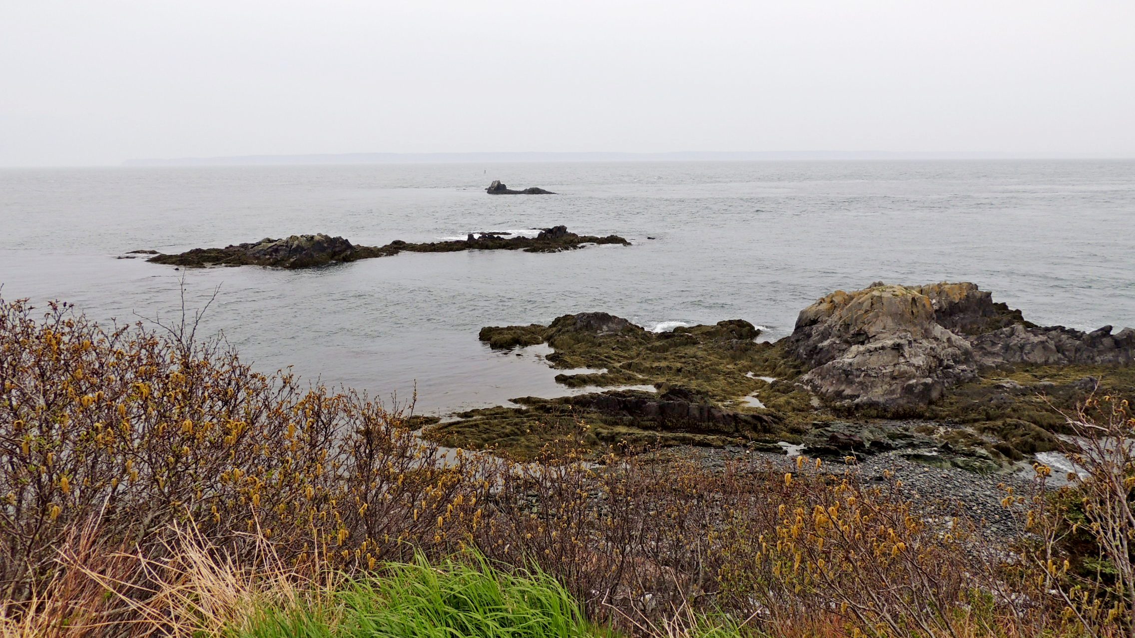
The easternmost point in the US is Sail Rock, a few hundred feet off the eastern tip of Quoddy Head in Eastern Maine. Sail Rock is the third and last in a series of rocks off the shore. It has been a navigational hazard to shipping for as long as man has sailed these waters. As a result, a lighthouse, the Quoddy Head Lighthouse, stands on the coast nearby and a groaner buoy has been installed on the seaward side of the rock.
All the land that one sees offshore from this point is in Canada, with Grand Manan Island being to the southeast and Campobello Island to the northeast. Some information on the area, from nearby plaques, is included below.
QUODDY HEAD STATE PARK
Quoddy Head State Park, located on the peninsula of West Quoddy Head, is the easternmost point in the United States. Steep rock cliffs, a peat bog and trees shaped by harsh winds characterize the park's environment. West Quoddy Head is wrapped in fog for an average of 59 days a year, and has some of Maine's coolest summer temperatures. Over time, these temperatures, a moist climate and the area's topography created conditions for the formation of a coastal peat bog — a park feature typical of maritime eastern Maine and New Brunswick.
The park's rock cliffs are remnants of marine volcanoes that erupted 420 million years ago and now form the bedrock of much of coastal Maine and New Brunswick. The horizontal volcanic layers were tilted almost to vertical along the Fundean fault - a fracture in the earth's crust that parallels the coast just off the park's shores. Glacial scouring and the battering surf have carved the cliffs, which rise 90 to 150 feet from the sea.
From the Plaque
Address and /or location:
Quoddy Head State Park, Quoddy Head Light, Lubec, ME

Who put it there (Sponsor): Bureau of Parks & Recreation, Maine Department of Conservation
Date (Erected or Dediated): January 1, 2000
|
Visit Instructions:
1) A new photo taken by you. Make it a quality one. You do not have to be in it, nor your hand held.
2) Some new insight to the history, and/or your personal experience finding the site.
|