To recognize the "The Ditch" a 16 x 20 bronze commemorative plaque is located in the a linear park on Fairview Road near the High School. This was a recent beautification project turning this unused area into a lovely park. There are desert plants, walking paths, dedicated benches and a picnic table for locals and visitors to enjoy.
John Oliver first and foremost was affectionately known as "Honest John". John Oliver's vision for the Okanagan Valley transformed it from an arid unproductive area, its potential untapped until in 1919.
John Oliver was born in Hartington, England July 31, 1856, the family moved Ontario in 1870, and moved to BC in 1877 and took up farming in Delta.
John Oliver was raised in a rural farming community though he loved the land, he had higher expectations to enter politics.
After serving in local politics he was elected to the BC legislature in 1900, and appointed Minister of Agriculture and Railways.
With the death of the current Premier, Harlan Brewster in 1918, John Oliver became the Province of British Columbia's 19th Premier, serving until his death on August 17, 1927.
"Following the First World War, BC’s premier, known as “Honest” John Oliver, envisioned an irrigation canal, which would bring this dry Sonora Desert region to life. The South Okanagan Lands Project was born, creating jobs and long term opportunities for veterans returning from World War I. The original townsite of Oliver was surveyed in 1921. Completed in 1923, the concrete irrigation canal (locally known as “the ditch”) soon transformed this desert region into lush orchards and farms."
Source: Oliver
"14. THE DITCH
Gala Street represents the path of the West Lateral branch of the South Okanagan Lands Project, aka “The Ditch”.
“The Ditch” was an initiative created by Premier John Oliver to provide immediate and long-term economic opportunities for soldiers returning from WWI. The BC legislature paid $350,000 for 22,000 acres of land in the Okanagan region from McIntyre Bluff to the US border. Premier Oliver recognized the great agricultural potential in the region; but as the Okanagan is Canada’s only desert area, he needed to get water to the future farms and gardens. Thus began the South Okanagan Lands Project (SOLP).
The project consisted of a 25-mile long gravity-fed pipe and canal system constructed from cement, wooden siphons and flumes. Construction began in 1918 and ran until 1925. Many side industries including logging, sawmills, and engineering camps grew up to support the project. Oliver survives as a lasting monument to this immense undertaking.
The West Lateral branch (represented by Gala St.) carried water from the main pipe to the homes and orchards north of Oliver by following the side of the valley.
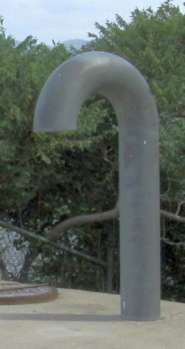
The modern pipes you are standing beside mark the western end of one of the SOLP projects greatest engineering marvels, a huge wooden siphon (photograph on the tour cover and below). The siphon ran up what is now School Avenue and without it, the West Lateral and the continuation of the Ditch would not have been possible. The water flowing along the pipe in this area moves uphill to this point, due in part to the laws of gravity!"
Source: Oliver Heritage Walking Tour
THE DITCH
THE DITCH IS THE LIFE LINE OF A COMMUNITY, OUR COMMUNITY, TURNING A ONCE SEMI-ARID DESERT REGION INTO THE VIABLE AGRICULTURAL GROWING OASIS IT IS TODAY.
IN 1918, "HONEST JOHN OLIVER", BC'S PREMIER, CAMPAIGNED TO PASS THE "SOLDIERS LAND ACT" WHICH ENABLED THE PROVINCE TO PURCHASE 22,000 ACRES OF LAND BETWEEN MCINTYRE BLUFF AND THE US BORDER TO BUILD AN IRRIGATION CANAL. THE CANAL INTENDED TO IRRIGATE 8,000 ARES OF DESERT LAND ON EACH SIDE OF THE OKANAGAN RIVER INTO VIABLE AGRICULTURAL LAND.
IN 1919, THE SOUTH OKANAGAN LANDS PROJECT WAS BORN. SURVEYING, MAPPING AND CONSTRUCTION WAS UNDERWAY EMPLOYING 100-150 MEN OVER THE NEXT 7 YEARS. THE CANAL, KNOWN AS "THE DITCH" HAD AN OVERALL LENGTH OF 40 CONCRETE-LINED KM, ORIGINALLY TO BE OPEN EARTH. BY 1923 THE CANAL REACHED TESTALINDA CREEK. IN 1927 THE CANAL WAS FULLY FINISHED AND ABLE TO BRING WATER FROM THE BLUFF TO THE US BORDER; A TOTAL OF 23 MILES (37 KM)
PROVINCE MANAGED THE CANAL FROM 1919 TO 1964 WHEN IT WAS TURNED OVER TO THE OLIVER AND OSOYOOS FRUIT GROWERS THAT BECAME THE SOUTH OKANAGAN LANDS IRRIGATION DISTRICT (SOLID). iN 1989 THE CANAL WAS TURNED OVER TO LOCAL GOVERNMENT WITH OLIVER ASSUMING 60% OF THE ASSETS, AND OSOYOOS 40%.
TODAY, IN 2019, OLIVER PROVIDES 601 IRRIGATION WATER SERVICES, IRRIGATING 5,200 ACRES OF FARMLAND WITH 1,025 ACRES PUMPING THEIR OWN WATER FROM THE TOWN'S IRRIGATION CANAL. 455 ACRES OF NON-FARM LAND IS ALSO IRRIGATED.
Town of
Oliver
Canada's Wine Capital
Plaque Text