Mount Goudreau - Louis Creek, British Columbia
Posted by: Groundspeak Premium Member T0SHEA
N 51° 08.305 W 120° 07.403
10U E 701232 N 5669151
Mount Goudreau cairn is at the Dragon Fire information kiosk and wood carvings. Off the Yellowhead Highway. Look for the turnoff.
Waymark Code: WM14PVP
Location: British Columbia, Canada
Date Posted: 08/08/2021
Views: 1

MOUNT GOUDREAU


Named for North Thompson pioneer
Andre Gaudreau
5 May 1863 — 11 January 1947
Andre was a 6th generation Canadian and descendant of
Jean Gaudreau who arrived in New France around 1670
from La Flotte, lie de Re, France.

Andre moved to Kamloops from Quebec
in 1894. He married Elmire St-Amour
(12 Aug. 1876 — 14 Jan. 1952) in 1896.
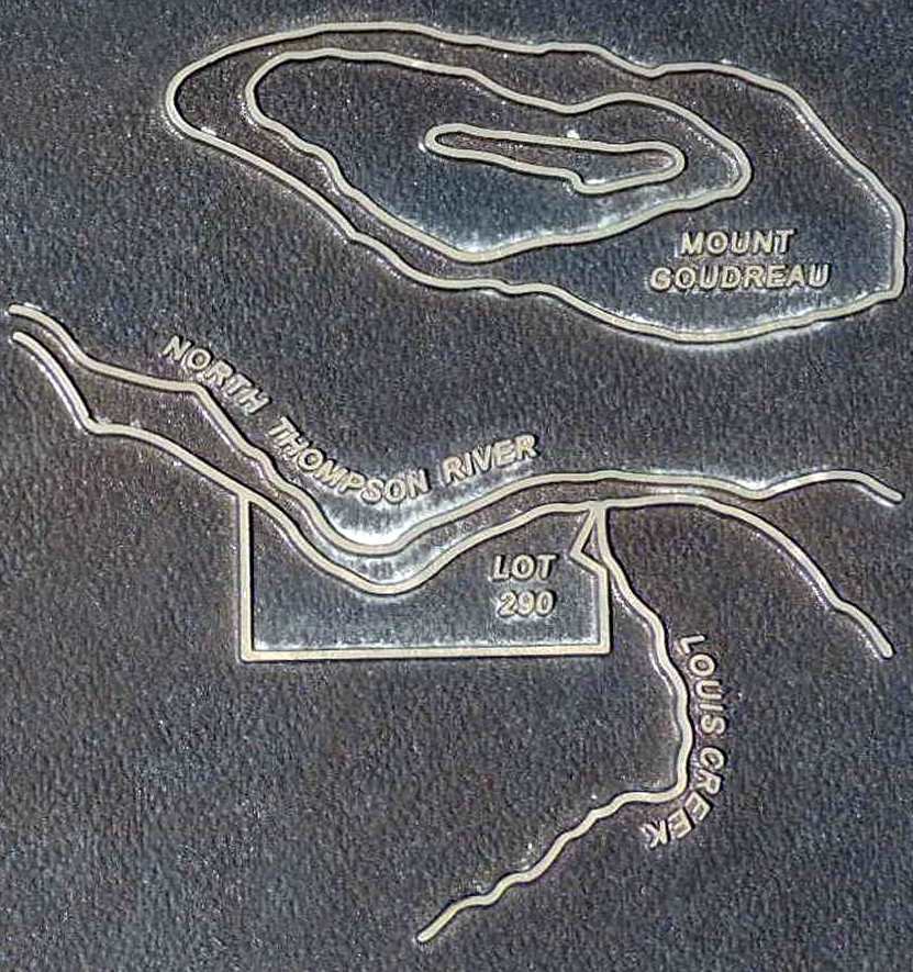
In 1899 they purchased a farm just
across the river (District Lot 290).
The farm included a stopping house, store
and post office (Louis Creek) which
they continued to operate until 1931.

Placed in 2010 to honour a pioneer by the descendants
of Andre Gaudreau

Type of Marker: Cultural

Type of Sign: British Columbia Tourism Sign

Describe the parking that is available nearby: Parking lot

What Agency placed the marker?: Descendants of Andre Gaudreau

Visit Instructions:
When entering a new log for visiting a waymark please provide a picture of your visit to the location and if you have an interesting alternate area or sign photo include that.

Please include any thoughts or historic information about the area that the marker may represent.
Search for...
Geocaching.com Google Map
Google Maps
MapQuest
Bing Maps
Nearest Waymarks
Nearest British Columbia Heritage Markers
Nearest Geocaches
Create a scavenger hunt using this waymark as the center point
Recent Visits/Logs:
There are no logs for this waymark yet.