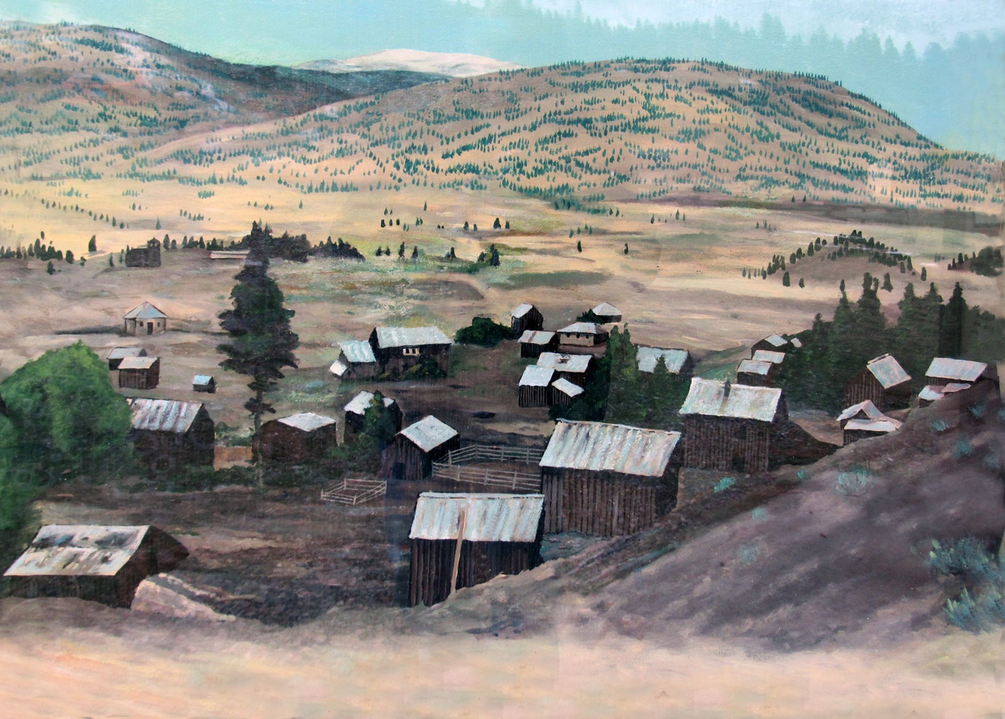
Fairview, in spite of prevailing opinion of the time, burst into existence, flourished and died as quickly as most other gold rush towns of the time. One of the largest and most elegant hotels of the era, the
Fairview Grand Hotel (nicknamed "the Big Tee-Pee) was built and burned in just five short years. It was never rebuilt and its demise sounded the death knell for the town, as the gold diggings were already beginning to play out when it burned.
Essentially nothing remains of Fairview except several historical markers. As well as a Province of British Columbia heritage marker, at the townsite one will find this kiosk, with several markers outlining the history of Fairview, nearby towns and gold rushes of the southern BC Interior.
Well before the first prospectors stumbled into the Okanagan Valley, the fur traders arrived. By the time gold was being hauled out of the valley, the fur traders had been doing business here for nearly a century. This three part marker examines a bit of that story.
The site of the Presbyterian Church has been marked, but is otherwise indistinguishable from the surroundings. Constructed at Fairview in 1899, it was moved to Okanagan Falls in 1929 and is affectionately known as
The Blasted Church for the method in which it was disassembled for transport (Hint - dynamite was involved). The wooden
Fairview Jail, the last remnant of Fairview, was moved to the Oliver Museum in 1981.

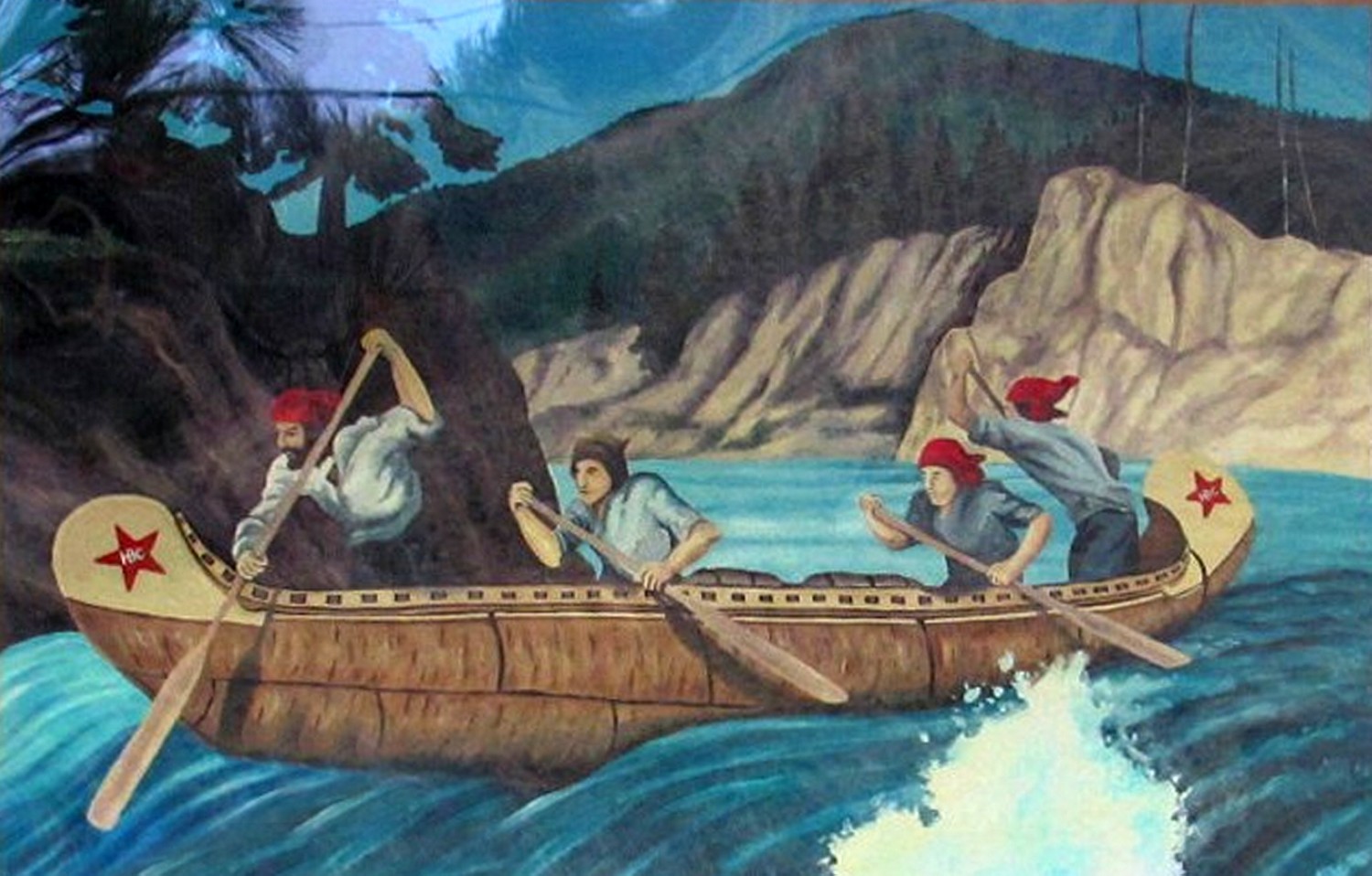
Fur Brigade
 Fur Brigade
Initially, First Nations people did almost all the trapping and the furs were transported by horseback, often times using established trade routes and overland trails, or by boat on the rivers. They delivered the furs to trading posts to exchange them for goods and supplies, such as; guns, cloth, tools and other manufactured goods from Europe.
By 1821 what is now British Columbia was the exclusive trading region for the British Hudson's Bay Company.
The Okanagan Valley was a main corridor for Hudson's Bay Company (HBC) Fur Brigades which tapped the rich resources of New Caledonia (as British Columbia was first known) and the Far North.
Furs from the northern HBC forts of St. John, St. James and St. George, Alexandria, McLeod and Kamloops were transported to Forts Astoria and Vancouver, established at the mouth of the Columbia River, in Oregon Territory, from whence the cargoes were shipped to European countries.
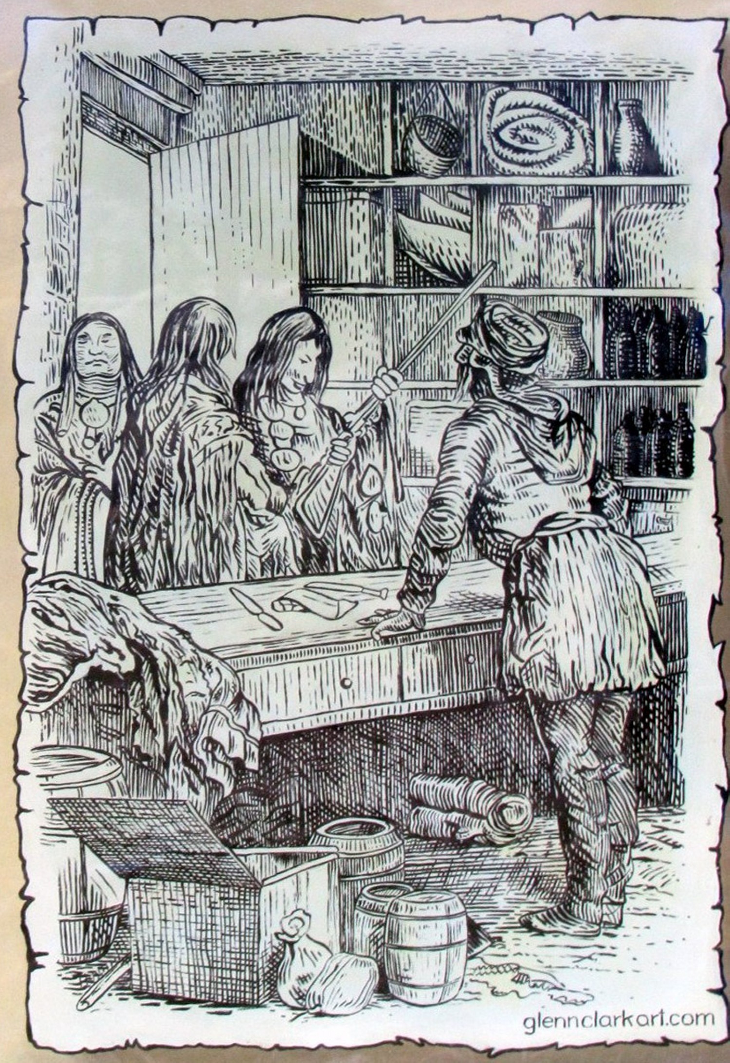
 Trading Posts
In 1811, a fur trading post, Fort Okanogan, was built at the confluence of the Okanagan and Columbia rivers, in what later became Washington State. Horses and canoes were used on the 1,000-mile HBC trail and sometimes as many as 200 horses, each carrying two 85 lb. bales of fur and travelling 15 to 18 miles a day, left Kamloops for the south.
In 1827, Fort Langley was established as an HBC trading post on the Fraser river and, in 1846, when the Oregon Treaty declared the 49th Parallel to be the boundary between American and British North America. HBC abandoned its trading posts south of the border. The last "outfit" travelled the Okanagan route the following year.
 Hello Good Friends
KLAHOWYA KLOSHE TILLICUMS (in the Chinook language it means, HELLO GOOD FRIENDS).
The many different cultures, in the early days, used the Chinook language to communicate. It had a vocabulary of about 300 words taken from several different languages.
It was spoken slowly and loudly with a great flourish of explanatory hand and facial expressions.
From the Historical Marker