|
 Alcove Spring, Kansas Posted by:  Rose Red Rose Red
N 39° 44.999 W 096° 40.759
14S E 698823 N 4402583
Alcove Spring (near Marysville and Blue Rapids, KS) has been called the most significant historic site on the Oregon Trail. This popular campsite was mentioned in many emigrant journals.
Waymark Code: WM1RQQ
Location: Kansas, United States
Date Posted: 07/03/2007
Views: 100
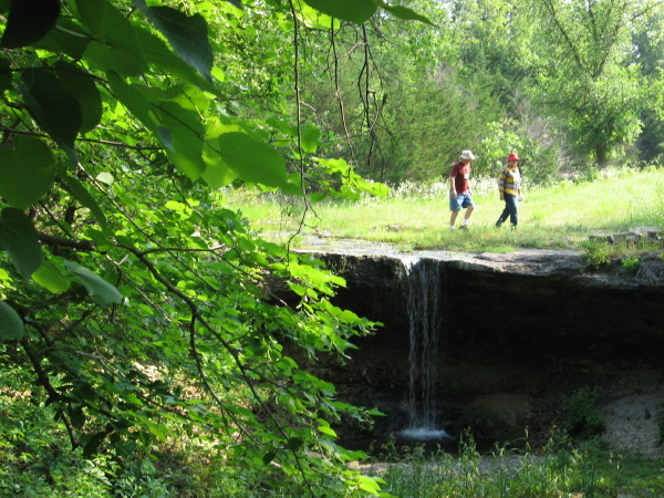
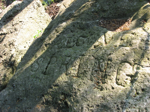
I traveled The Oregon Trail with an Elderhostel group from Kansas City/Independence, Missouri to Oregon City, Oregon June 13-28, 2007. We visited Alcove Spring on our way to Kearney, Nebraska on Saturday, June 16. Alcove Spring (near Marysville and Blue Rapids, KS) has been called the most significant historic site on the Oregon Trail. This popular campsite was mentioned in many emigrant journals, noting the cold, clear rushing water, tall native grasses, and beautiful wildflowers blooming in profusion near the spring. There are many carvings on the ledge of the waterfall and rocks in the surrounding area. The mosquitoes were huge and persistent. Here the emigrants left the tall-grass prairie of eastern Kansas and entered the short-grass country of the semi-arid plains.
Road of Trail Name: The Oregon Trail

State: Kansas
County: Marshall
Historical Significance:
This popular campsite was mentioned in many emigrant journals, noting the cold, clear rushing water, tall native grasses, and beautiful wildflowers blooming in profusion near the spring.
Years in use: 1840s-1860s
How you discovered it:
I traveled The Oregon Trail with an Elderhostel group from Kansas City/Independence to Oregon City, Oregon June 13-28, 2007.
Book on Wagon Road or Trial:
"Traveling the Oregon Trail" by Julie Fanselow. Second Edition.
Why?:
Emigrants headed west to "see the elephant". Others wanted land. Some emigrants were motivated by pure patriotism and the notion of "manifest destiny." And others wanted to bring religion to the American Indians. Finally, many emigrants simply had the urge to push ever westward as their ancestors had done for generations.
Directions:
Alcove Spring is located west of U.S.-77 about 15 minutes south of U.S.-36. From Marysville take the River Road south along the Big Blue River.
Website Explination: Not listed
|
Visit Instructions:
To post a log for this Waymark the poster must have a picture of either themselves, GPSr, or mascot. People in the picture with information about the waymark are preferred. If the waymarker can not be in the picture a picture of their GPSr or mascot will qualify. There are no exceptions to this rule.
|