|
 San Joaquin River
N 37° 47.239 W 121° 18.413
10S E 649085 N 4183568
Californias second longest river, named after Saint Joaquin, the father of the virgin Mary.
Waymark Code: WM2H33
Location: California, United States
Date Posted: 11/03/2007
Views: 179
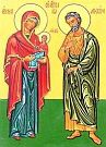 |
Saint Joachim is believed to be the husband of Saint Anne and the father of the Virgin Mary. The Bible does not explicitly name either of Mary's parents, but some argue that the genealogy in Luke 3 states that he is the father of Mary, thereby naming her father as Heli which may be short for "Eliakim," aka "Joachim". The story of Joachim and Anne appears in the apocryphal Proto-gospel of James. Saint Anne and Saint Joaquin
|
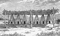 Yokut lodges at the River Yokut lodges at the River |
There is an old saying, "Thank God for the river, but thank the river for everything else." In the past, the extremely rich natural resources of the San Joaquin valley supported the densest population of non-agrarian Native Americans on the continent. At times, there were as many as 50,000 Yokut and Miwok living along the river, using the resources by the riparian groves on the banks of its rivers, sloughs and lakes and fished in its waters.
|
|
In the early 1800s, Spanish soldiers forced the Native American population from their villages on the banks of the San Joaquin and removed them to the Mission in San Juan Bautista. Later, Malaria and cholera eliminated approximately 75% of the population. Soon after, the mass immigrations of gold seekers during the 1850's reduced the Indians to a few scattered bands. By 1910 only 600 Yokut and Miwok remained.
|
 |
In 1822 a party led by Jedediah Smith spent a season trapping beaver on the San Joaquin and in 1829 another band of trappers, including Kit Carson, would return to the area. The first land grant was awarded to a Mexican rancher who settled in the San Joaquin Valley in 1836 and soon thereafter a homestead was claimed by a European settler on St. John's River near present day Visalia. Over the following decade 30 more land grants were deeded in the valley by the Mexican governor.
|
|
Today, most of the river's water is diverted for urban and agricultural uses, making the San Joaquin Valley part of the "Salad Bowl of the Nation" and also in recent years attracting more and more San Francisco commuters to newly founded bedroom communities along the river.
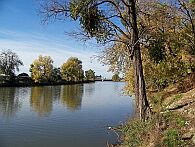
Here is a perfect example of how the use of the river's water has changed:
|
This is what it looked like a year ago |
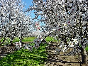
This is what it looks like now. |
Thank God for the river, but thank the river for everything else:
Bible verse: Luke 3:23 (King James Bible Translation): And Jesus himself began to be about thirty years of age, being (as was supposed) the son of Joseph, which was the son of Heli...

Person Place or Thing: Person
|
Visit Instructions:
Photos of the visitor with the waymarked feature in the background are strongly encouraged. If you're camera shy, nice photos of just the waymark target are fine.
Recent Visits/Logs:
| There are no logs for this waymark yet. |
|
|
|
|