
Allegany to Scottsburg Pack Trail - Coos County, OR
Posted by:  silverquill
N 43° 28.949 W 123° 55.969
10T E 424565 N 4814818
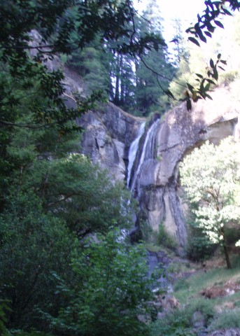
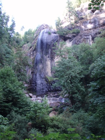
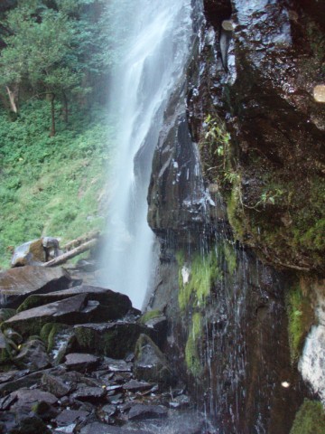
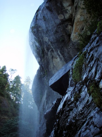
The road now ends here at Golden & Silver State Park, with views of the spectacular waterfalls with drops of 200, and 150 feet. But, once this road connected the Oregon coast to the interior over a precarious route up over the falls.
Waymark Code: WM5WE5
Location: Oregon, United States
Date Posted: 02/20/2009
Views: 1
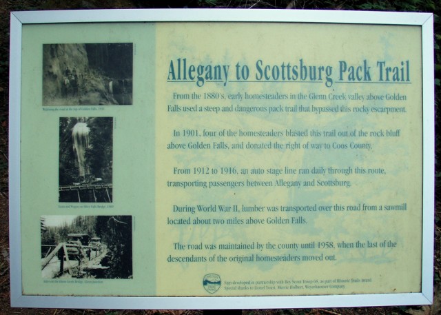
ALLEGANY TO SCOTTSBURG PACK TRAIL
Frm the 1880's, early homesteaders in the Glenn Creek valley above Golden Falls used a steep and dangerous pack trail that bypassed this rocky escarpment.
In 1901, four of the homesteaders blasted this trail out of the rock bluff above Golden Falls, and donated the right of way to Coos County.
From 1912 to 1916, and auto stage line ran daily through this route, transporting passengers between Allegany and Scottsburg.
During World War II, lumber was transported over this road from a sawmill located two mile above Golden Falls.
The road was maintained by the county until 1958, when the last of the descendants of the original homesteaders moved out.
Golden and Silver Falls State Park is only about 25 miles east of Coos Bay, starting out on Route 124, but the last portion of the road is gravel and very narrow and winding.. Use extreme caution. The lower trail to Silver Falls is a gentle climb, but ends unceremoniously at a clearing with a good view of the falls. The upper trail is longer and steeper, and ends at the other side of the falls for a closer view. Both trails are well maintained. There are unimproved trails that lead to the top, though they are apparently unmarked. The parking area is ample with picnic and restroom facilities. Day use only!
These photos were taken in August 2008, when the water flow is at the minimum, but still quite beautiful. A spring visit will give one the experience of the full power and grandeur of these spectacular waterfalls.
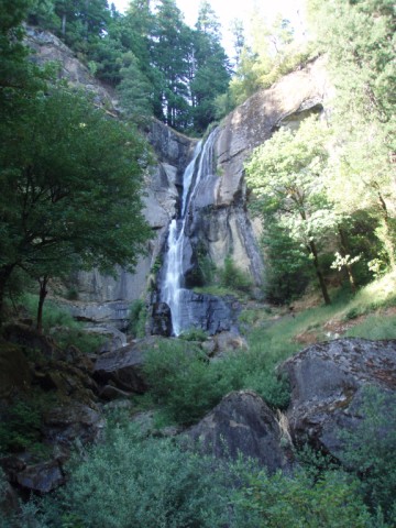
GOLDEN FALLS
Coos County, Oregon |
GOLDEN FALLS
Coos County, Oregon |
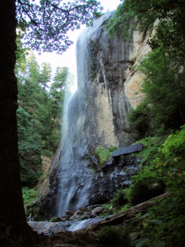
SILVER FALLS
Coos County, Oregon |
SILVER FALLS
Coos County, Oregon |
SILVER FALLS
Coos County, Oregon |
SILVER FALLS
Coos County, Oregon |
Visit Instructions:
Include your thoughts and observations pertaining to this location and your visit. Provide any additional history that you are aware of that pertains to this location. If the marker commemorates a historic building tell us what it is used for now or share with us the circumstances of an earlier visit to bring this locations history to life.
Please upload a favorite photograph you took of the waymark. Although visiting this waymark in person is the only thing required of you to receive credit for your visit, taking the time to add this information is greatly appreciated.
Be creative.