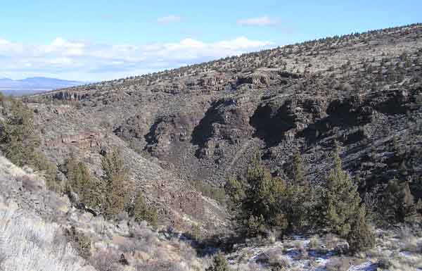
This “Beaver Board” sign on Oregon Geology about a Prehistoric River is located near milepost 20 on U.S. Hwy 20 east of Bend.
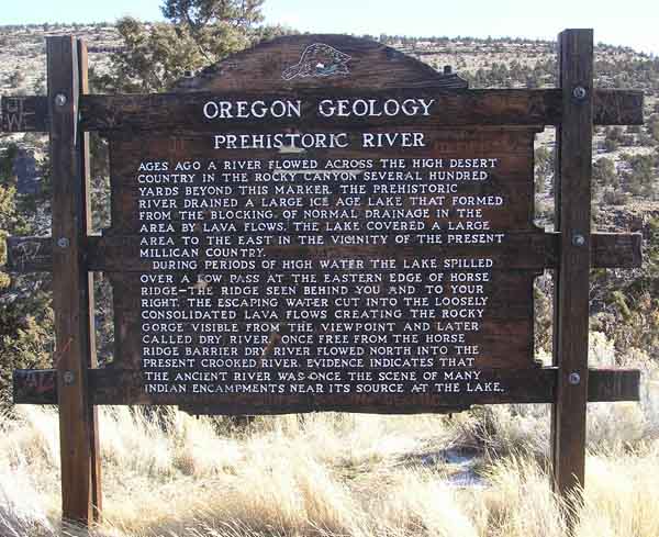
Marker Name: Prehistoric River
Marker Text: Ages ago a river flowed across the High Desert country in the rocky canyon several hundred yards beyond this marker. The prehistoric river drained a large ice age lake that formed from the blocking of normal drainage in the area by lava flows. The lake covered a large area to the east in the vicinity of the present Millican country.
During periods of high water the lake spilled over a low pass at the eastern edge of Horse Ride - the ridge seen behind you and to your right. The escaping water cut into the loosely consolidated lava flows creating the rocky gorge visible from the viewpoint and later called Dry River. Once free from the Horse Ridge barrier Dry River flowed north into the present Crooked River. Evidence indicates that the ancient river was once the scene of many indian encampments near its source at the lake.
Visit Instructions:
Include your thoughts and observations pertaining to this location and your visit. Provide any additional history that you are aware of that pertains to this location. If the marker commemorates a historic building tell us what it is used for now or share with us the circumstances of an earlier visit to bring this locations history to life.
Please upload a favorite photograph you took of the waymark. Although visiting this waymark in person is the only thing required of you to receive credit for your visit, taking the time to add this information is greatly appreciated.
Be creative.