D RIVER BEACH
Lincoln City, Oregon
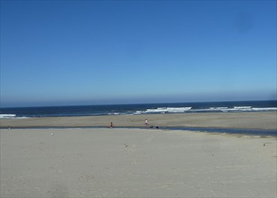
The D River Beach Wayside is a day use State Park recreation area on the south bank of the D River in Lincoln City. This sign is at the beach edge.
This area of the coast is very flat with numerous streams and rivers, including the D River here which is the outlet of the large Devil's Lake a scant 120 feet from the high tide mark, making this area very prone to serious damage from a tsunmai. The entire area of Lincoln City is barely 20 feet above sea level. In fact, a tsunami in 1700 did cause extensive damage as documented in a marker for The Great Tsunami of 1700, just three miles south of this location.
The main text of the marker:
Devastating waves called "tsumamis" can strike Oregon's coast at any time. These giant waves are caused
by great undersea earthquakes. Such earthquakes can occur along the Cascadia Subduction Zone, one of
the largest active faults in North America. This fault zone lies 32 to 70 miles offshore and roughly parallels
the coast.
Tsunamis are dangerous and destructive. They have struck the Oregon coast repeatedly and will again in
the future. Tsunamis can follow within minutes of an earthquake. They move rapidly but quickly run out
of water as they sweep inland and uphill. Flooding can occur several miles inland along rivers and
streams. Remember, most tsunamis are not solitary giant waves, instead, many large waves may strike the
shore over the course of several hours.
A cross section diagram carries this description:
The Juan de Fuca Plate is moving away from the Juan de Fuca Ridge and is being forced
under the overriding North American Plate. This geologic process is called subduction.
A coastal map from British Columbia to northern California showing the plates and fault zones carries this description:
The earth's surface consists of a series of "plates." These plates are constantly shifting and sliding over, under, or past each other. When a sudden movement occurs between two plates, we experience and earthquake.
A section giving the procedure to follow in case of a tsunami reads:
WHAT TO DO TO ESCAPE A TSUNAMI
* Protect yourself during the earth-
quake. After the earthquake,
immediately go inland and uphill.
* Do not return to the beach after the
first tsunami wave -- more may arrive
for several hours>
* Wait for official notice from
authorities that the danger has
passed before returning to the beach.
For additional information, contact your local
emergency planning office or the Oregon
Department of Geology and Mineral Industries.
The sign bears the logos of the Oregon Travel Information Council, Oregon State Parks, and Sea Reach Ltd.
Visit Instructions:
Include your thoughts and observations pertaining to this location and your visit. Provide any additional history that you are aware of that pertains to this location. If the marker commemorates a historic building tell us what it is used for now or share with us the circumstances of an earlier visit to bring this locations history to life.
Please upload a favorite photograph you took of the waymark. Although visiting this waymark in person is the only thing required of you to receive credit for your visit, taking the time to add this information is greatly appreciated.
Be creative.