|
 Columbia- Columbia, Mo Posted by:  trailhound1 trailhound1
N 38° 56.226 W 092° 18.447
15S E 560022 N 4310024
Columbia Historical Marker located at Old 63 Roadside Park in Columbia, Mo.
Waymark Code: WMD797
Location: Missouri, United States
Date Posted: 11/29/2011
Views: 17
The
marker describes that history of Columbia, Missouri. It is located at
the Old U.S. 63 Roadside Park. At one time this park was located in the
'country' and provided a respite from the city for those that wanted to
take a rural drive and a picnic.
Ed. Note: Not true, this was a roadside park, and still is, like hundreds of others across Missouri on US highways.
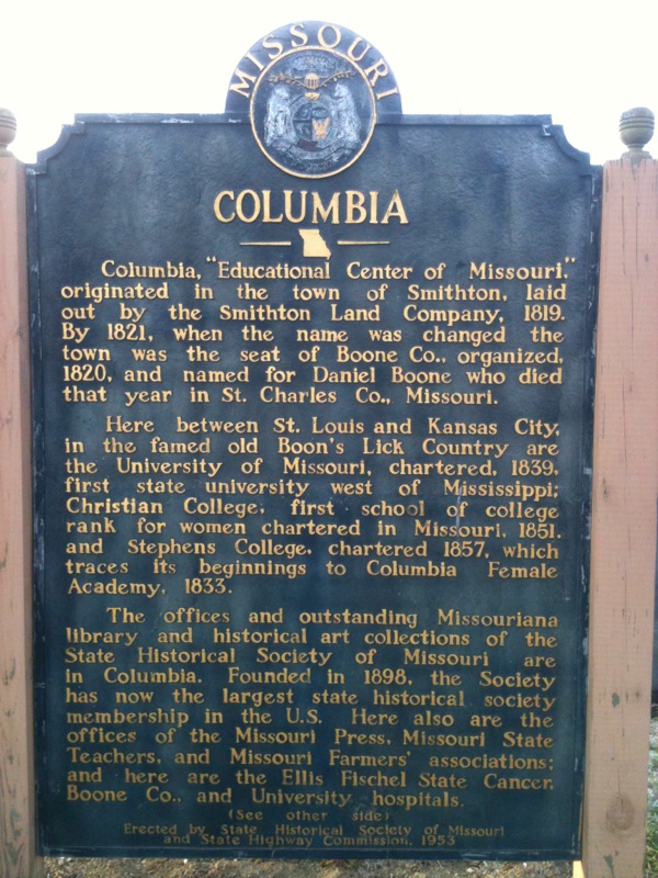
History of Mark:
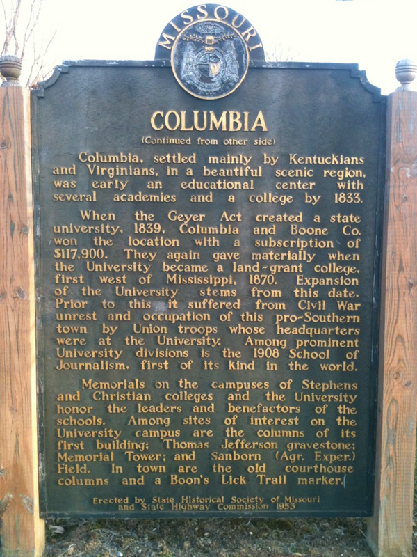
Erected by State Historical Society of Missouri and State Highway Commission in 1953.
Updates and corrections since marker was erected:
1. Christian College began accepting male students in May 1969 and was renamed Columbia College in 1970.
2. The Memorial Tower, dedicated in November 1926, was built to honor those who lost their lives in World War I.
3. The tower was constructed in the mid-1920's, with the wings added later. The north wing was finished in 1952 and the south wing in 1963, completing what is now known as the Memorial Union.

Web link: Not listed
Additional point: Not Listed
|
Visit Instructions:
A clear picture of the Marker or Plaque taken by you.
Also would appreciate you input on the text and location.
|