
Historic Quarter Section Marker - Medford, Oregon
Posted by:  ddtfamily
N 42° 19.429 W 122° 52.522
10T E 510269 N 4685737
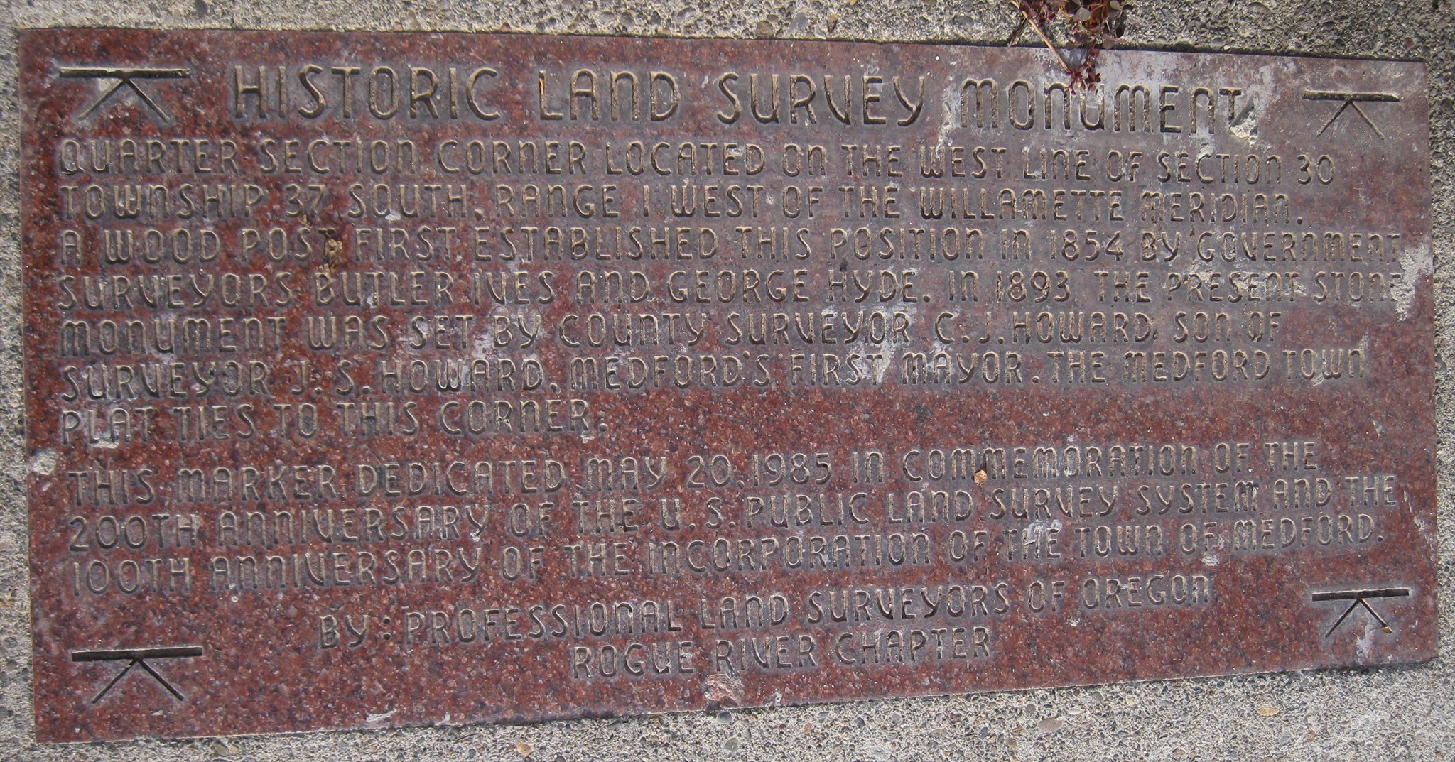
Marker describing the history of a survey monument in Medford's Alba Park
Waymark Code: WMFRXG
Location: Oregon, United States
Date Posted: 11/25/2012
Views: 3
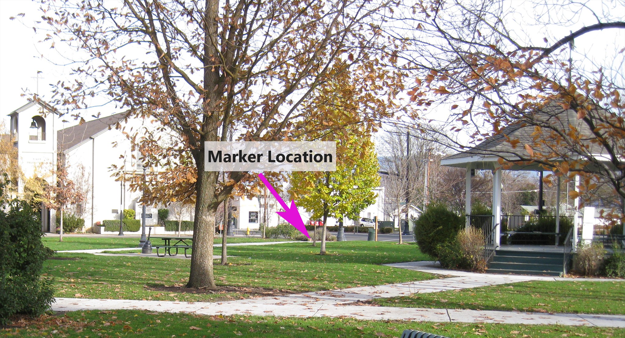
This marker describes the placement and use of a historic quarter section monument in Medford's Alba Park. It is located near the southeast corner of the park, across the street from the First Presbyterian Church (corner of Holly & 8th streets).
The text reads:
| HISTORIC LAND SURVEY MONUMENT QUARTER SECTION CORNER LOCATED ON THE WEST LINE OF SECTION 30
TOWNSHIP 37 SOUTH, RANGE 1 WEST OF THE WILLAMETTE MERIDIAN.
A WOOD POST FIRST ESTABLISHED THIS POSITION IN 1854 BY GOVERNMENT
SURVEYORS BUTLER IVES AND GEORGE HYDE. IN 1893 THE PRESENT STONE
MONUMENT WAS SET BY COUNTY SURVEYOR C.J. HOWARD, SON OF
SURVEYOR J.S. HOWARD, MEDFORD'S FIRST MAYOR. THE MEDFORD TOWN
PLAT TIES TO THIS CORNER. THIS MARKER DEDICATED MAY 20, 1985 IN COMMEMORATION OF THE
200TH ANNIVERSARY OF THE U.S. PUBLIC LAND SURVEY SYSTEM AND THE
100TH ANNIVERSARY OF THE INCORPORATION OF MEDFORD. BY: PROFESSIONAL LAND SURVEYORS OF OREGON
ROGUE RIVER CHAPTER |
Visit Instructions:
Include your thoughts and observations pertaining to this location and your visit. Provide any additional history that you are aware of that pertains to this location. If the marker commemorates a historic building tell us what it is used for now or share with us the circumstances of an earlier visit to bring this locations history to life.
Please upload a favorite photograph you took of the waymark. Although visiting this waymark in person is the only thing required of you to receive credit for your visit, taking the time to add this information is greatly appreciated.
Be creative.