
Step Toward History - Salem, Oregon
Posted by:  ddtfamily
N 44° 56.534 W 123° 02.247
10T E 497045 N 4976533
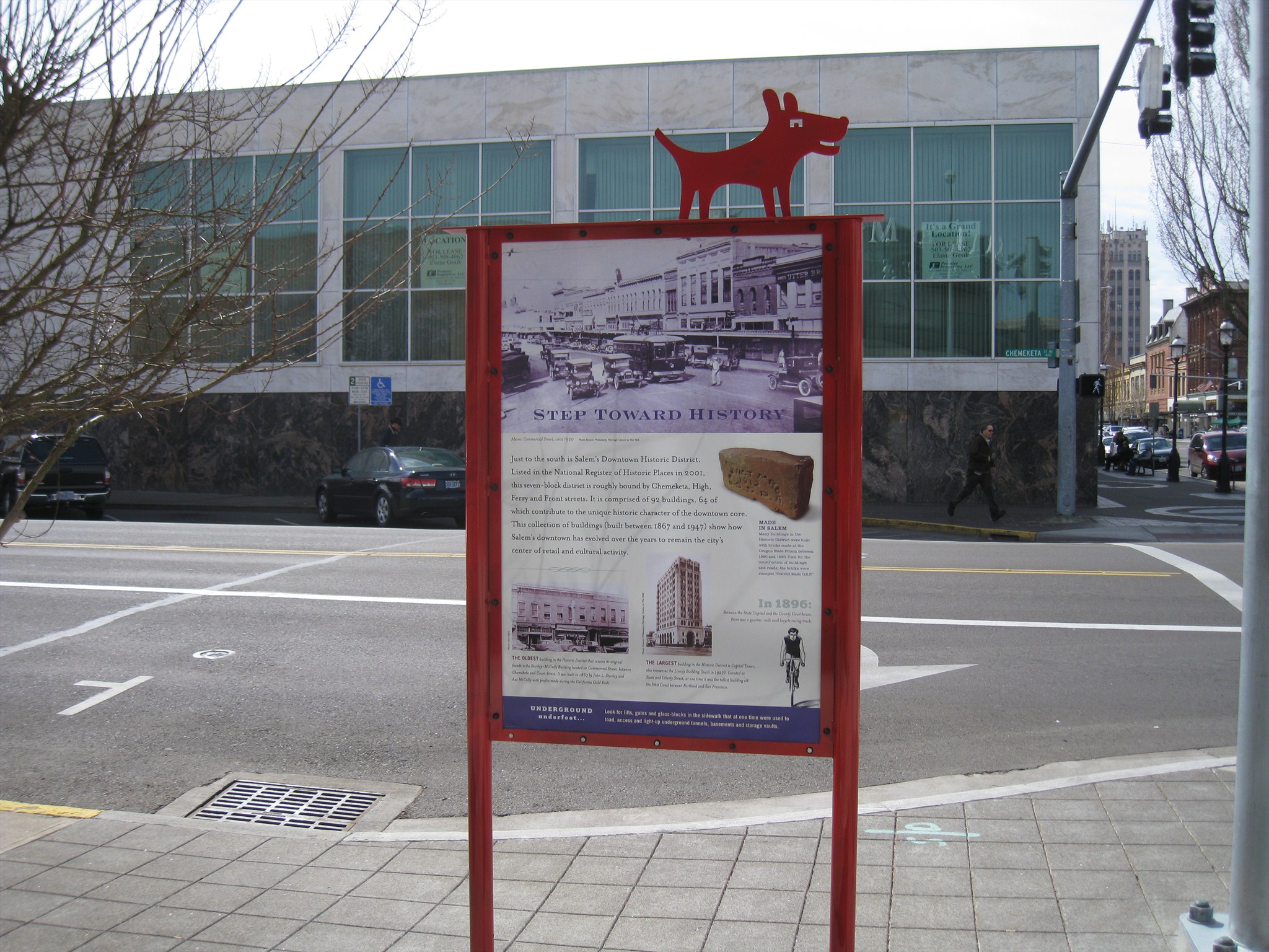
Historical marker in front of Salem Center
Waymark Code: WMGPDC
Location: Oregon, United States
Date Posted: 03/27/2013
Views: 1
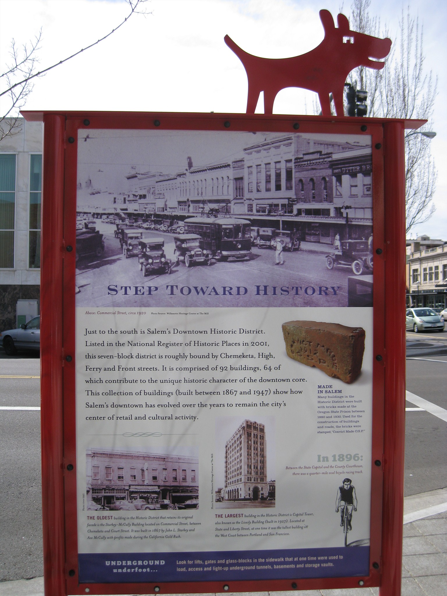
This marker is one of a series placed around Salem to give visitors information about the city's history. It is found at the Chemeketa & Liberty Street entrance to Salem Center. The marker text reads:
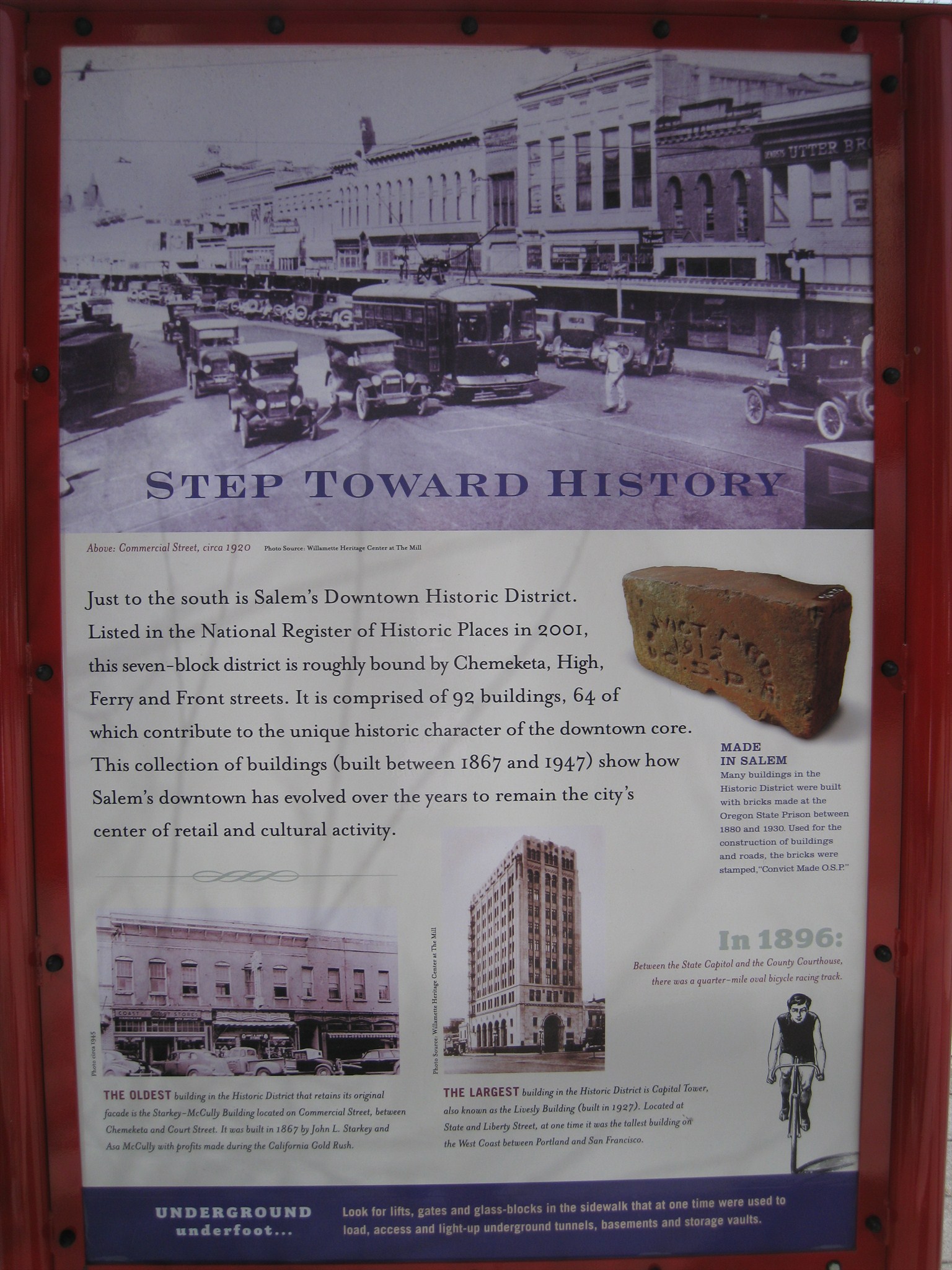
STEP TOWARD HISTORY
Just to the south is Salem's Downtown Historic District. Listed in the National Register of Historic Places in 2001, this seven-block district is roughly bounded by Chemeketa, High, Ferry and Front streets. It is comprised of 92 buildings, 64 of which contribute to the unique character of the downtown core. This collection of buildings (built between 1867 and 1947) show how Salem's downtown has evolved over the years to remain the city's center of retail and cultural activity.
UNDERGROUND underfoot... Look for lifts, gates and glass-blocks in the sidewalk that at one time were used to load, access and light-up underground tunnels, basements and storage vaults.
Photo Captions:
Above: Commercial Street, circa 1920
MADE IN SALEM: Many buildings in the Historic District were built with bricks made at the Oregon State Prison between 1880 and 1930. Used for the construction of buildings and roads, the bricks were stamped, "Convict Made O.S.P."
In 1896: Between the State Capitol and the County Courthouse, there was a quarter-mile oval bicycle racing track.
THE OLDEST building in the Historic District that retains its original facade is the Starkey-McCully Building located on Commercial Street, between Chemeketa and Court Street. It was built in 1867 by John L. Starkey and Asa McCully with profits made during the California Gold Rush.
THE LARGEST building in the Historic District is Capital Tower, also known as the Livesly Building (built in 1927). Located at State and Liberty Street, at one time it was the tallest building on the West Coast between Portland and San Francisco.
Click a photo to enlarge
On the backside of this marker is a "You are Here" map, designed to orient pedestrians to Salem's nearby points of interest.
Visit Instructions:
Include your thoughts and observations pertaining to this location and your visit. Provide any additional history that you are aware of that pertains to this location. If the marker commemorates a historic building tell us what it is used for now or share with us the circumstances of an earlier visit to bring this locations history to life.
Please upload a favorite photograph you took of the waymark. Although visiting this waymark in person is the only thing required of you to receive credit for your visit, taking the time to add this information is greatly appreciated.
Be creative.