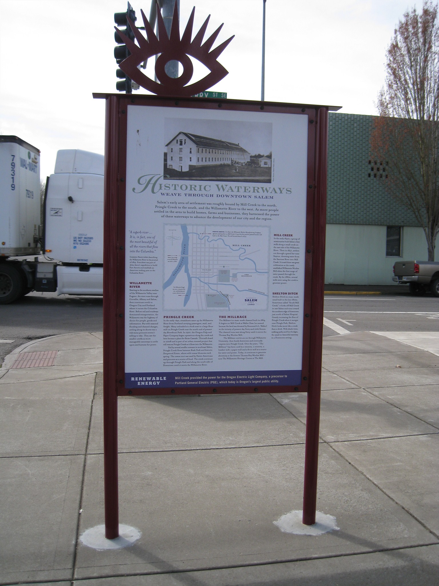
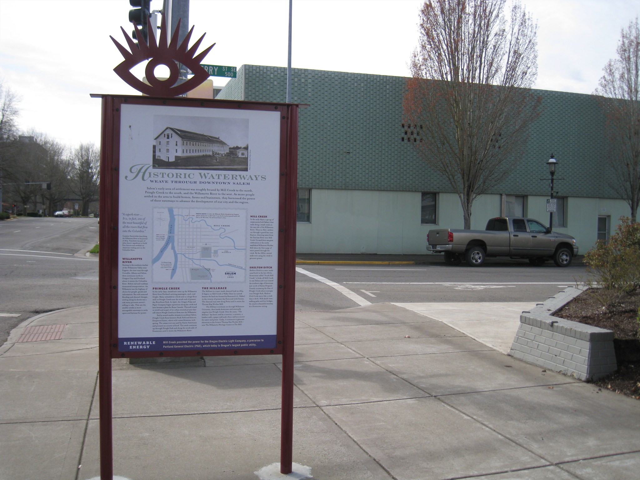
This marker is one of a series placed around Salem to give visitors information about the city's history. It is found at the corner of Church & Ferry streets in downtown Salem. The marker text reads:
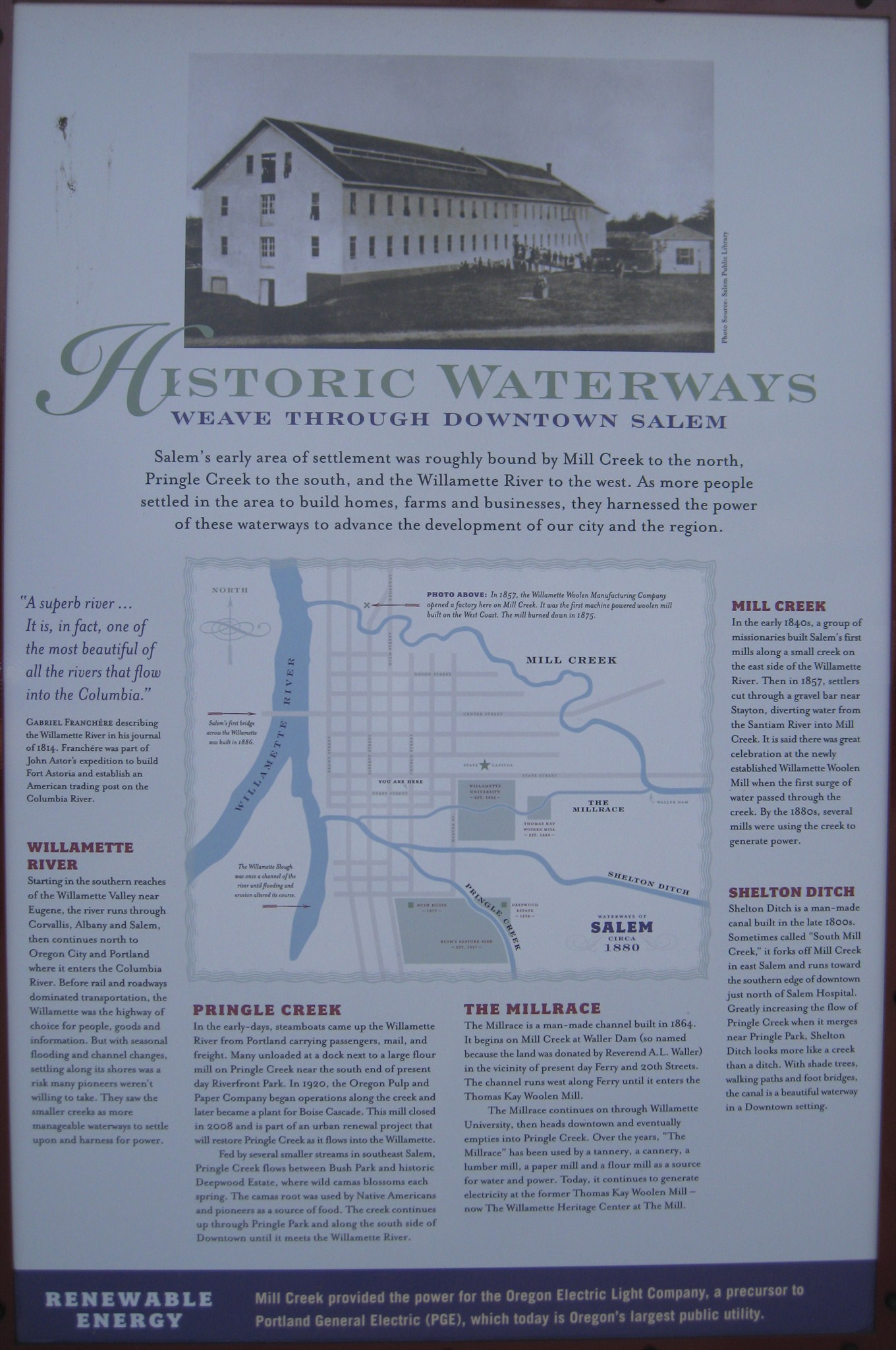
HISTORIC WATERWAYS
WEAVE THROUGH DOWNTOWN SALEM
Salem's early area of settlement was roughly bounded by Mill Creek to the north,
Pringle Creek to the south, and the Willamette River to the west. As more people
settled in the area to build homes, farms and businesses, they harnessed the power
of these waterways to advance the development of our city and the region.
"A superb river...It is, in fact, ofe of the most beautiful of all rivers that flow into the Columbia." - Gabriel Franchere describing the Willamette River in his journal of 1814. Franchere was part of John Astor's expedition to build Fort Astoria and establish an American trading post on the Columbia River.
WILLAMETTE RIVER - Starting in southern reaches of the Willamette Valley near Eugene, the river runs through Corvallis, Albany and Salem, then continues north to Oregon City and Portland where it enters the Columbia River. Before rail and roadways dominated transportation, the Willamette was the highway of choice for people, goods and information. But with seasonal flooding and channel changes, settling along its shores was a risk many pioneers weren't willing to take. They saw the smaller creeks as more manageable waterways to settle upon and harness for power.
PRINGLE CREEK - In the early-days, steamboats came up the Willamette River from Portland carrying passengers, mail, and freight. Many unloaded at a dock next to a large flour mill on Pringle Creek near the south end of present day Riverfront Park. In 1920, the Oregon Pulp and Paper Company began operations along the creek and later became a plant for Boise Cascade. This mill closed in 2008 and is part of an urban renewal project that will restore Pringle Creek as it flows into the Willamette.
Fed by several smaller streams in southeast Salem, Pringle Creek flows between Bush Park and historic Deepwood Estate, where wild camas blossoms each spring. The camas root was used by Native Americans and pioneers as a source of food. The creek continues up through Pringle Park and along the south side of Downtown until it meets the Willamette River.
THE MILLRACE - The Millrace is a man-made channel built in 1864. It begins on Mill Creek at Waller Dam (so named because the land was donated by Reverend A.L. Waller) in the vicinity of present day Ferry and 20th Streets. The channel runs west along Ferry until it enters the Thomas Kay Woolen Mill.
The Millrace continues on through Willamette University, then heads downtown and eventually empties into Pringle Creek. Over the years, "The Millrace" has been used by a tannery, a cannery, a lumber mill, a paper mill and a flour mill as a source for water and power. Today it continues to generate electricity at the former Thomas Kay Woolen Mill - now The Willamette Heritage Center at The Mill.
SHELTON DITCH - Shelton Ditch is a man-made canal built in the late 1800s. Sometimes called "South Mill Creek," it forks off Mill Creek in east Salem and runs toward the southern edge of downtown just north of Salem Hospital. Greatly increasing the flow of Pringle Creek when it merges near Pringle Park, Shelton Ditch looks more like a creek than a ditch. With shade trees, walking paths and foot bridges, the canal is a beautiful waterway in a Downtown setting.
RENEWABLE ENERGY - Mill Creek provided the power for the Oregon Electric Light Company, a precursor to Portland General Electric (PGE), which today is Oregon's largest public utility.
Marker Photo caption: In 1857, the Willamette Woolen Manufacturing Company opened a factory here (referring to a point on the map) on Mill Creek. It was the first machine powered woolen mill built on the West Coast. The mill burned down in 1875.
Other map captions: Salem's first bridge across the Willamette was built in 1866; The Willamette Slough was once a channel of the river until flooding and erosion altered its course.
Click a photo to enlarge
On the backside of this marker is a "You are Here" map, designed to orient pedestrians to Salem's nearby points of interest.