
Two Regions Meet - Siskiyou County, CA
N 41° 44.290 W 121° 31.747
10T E 622315 N 4621751
This orientation table is located within the Lava Beds National Monument (seasonal fees may apply) and at the Schonchin Butte Fire Lookout in Siskyou County, CA.
Waymark Code: WMGWAK
Location: California, United States
Date Posted: 04/15/2013
Views: 3
This orientation table is located at the Schonchin Butte Fire Lookout and focuses on the Medicine Lake shield volcano and reads:
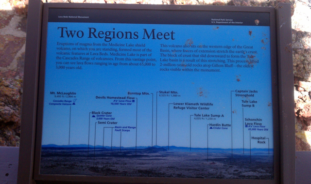
Two Regions Meet
Eruptions of magma from the Medicine Lake shield volcano, on which you are standing, formed most of the volcanic features at Lava Beds. Medicine Lake is part of the Cascades Range of volcanoes. From this vantage point, you can see lava flows ranging in age from about 65,000 to 3,000 years old.
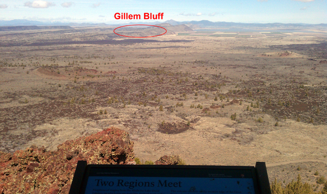
This volcano also sits on the western edge of the Great Basin, where forces of extension stretch the earth's crust. The block of crust that slid downward to form the Tulelake basin is a result of this stretching. This process lifted 2-million-year old rocks atop Gillem Bluff--the oldest rocks visible within the monument.
_____________________________________________________
Gillem Bluff is a long stretch of land that flows from north to south and visitors to the Lava Beds can drive along next to it on their way to Schonchin Bute Fire Lookout. Visitors who are able to make the trek up to Schonchin Butte Lookout are welcomed with some spectacular views of the surrounding landscape.