
Against Flood & Fire - Salem, Oregon
Posted by:  ddtfamily
N 44° 56.856 W 123° 02.792
10T E 496329 N 4977130
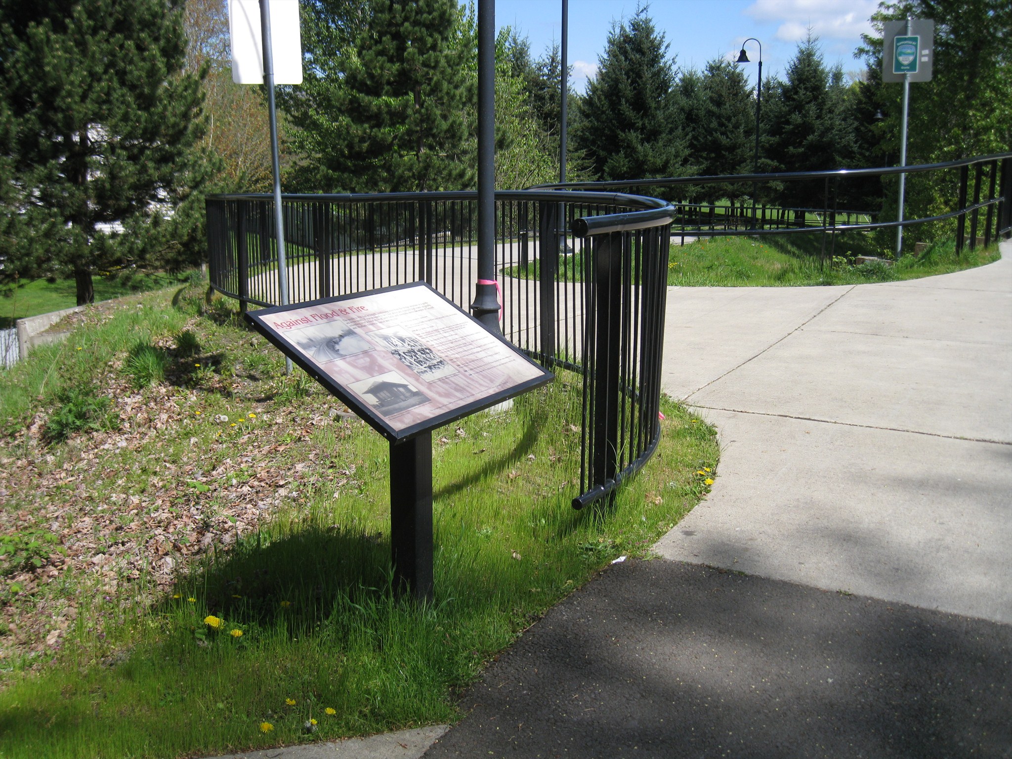
History marker documenting the nearby railroad trestle
Waymark Code: WMGX67
Location: Oregon, United States
Date Posted: 04/19/2013
Views: 3
This marker provides information about the history of the railroad trestle that connected the
Union Street Bridge with the west side of the line. It was placed at the west end of the bridge trestle in connection with the conversion of the bridge from an abandoned rail crossing to a pedestrian and bicycle path. The marker is adjacent to a "
You Are Here" map and another history marker. The marker text reads:
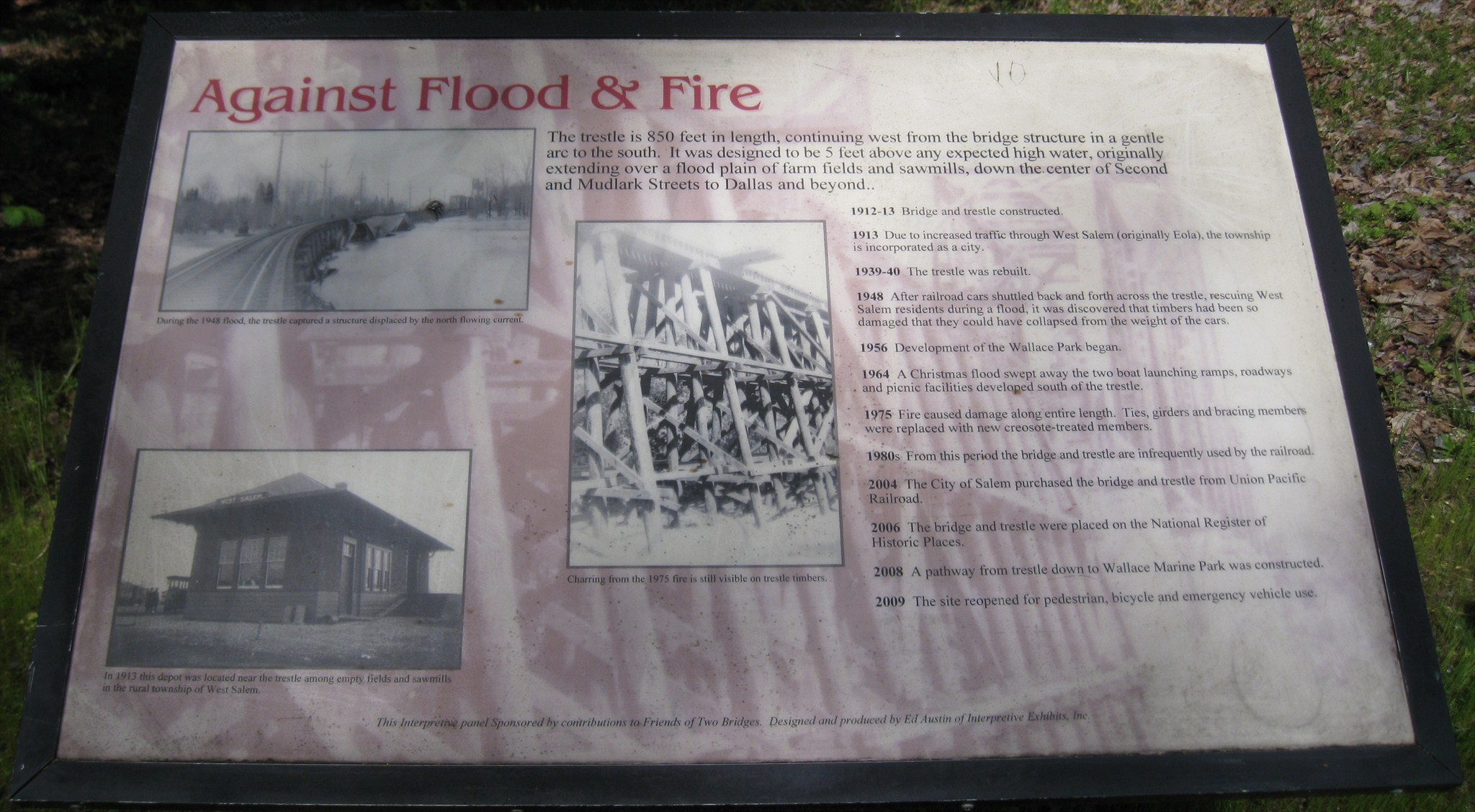
Against Flood & FireThe trestle is 850 feet in length, continuing west from the bridge structure in a gentle arc to the south. It was designed to be 5 feet above any expected high water, originally extending over a flood plain for farm fields and sawmills, down the center of Second and Mudlark Streets to Dallas and beyond.
1912-13 Bridge and trestle constructed.
1913 Due to increased traffic through West Salem (originally Eola), the township is incorporated as a city.
1939-40 The trestle was rebuilt.
1948 After railroad cards shuttled back and forth across the trestle, rescuing West Salem residents during a flood, it was discovered that timbers had been so damaged that they could have collapsed from the weight of the cars.
1956 Development of Wallace Park began.
1964 A Christmas flood swept away the two boat launching ramps, roadways and picnic facilities developed south of the trestle.
1975 Fire caused damage along entire length. Ties, girders and bracing members were replaced with new creosote-treated members.
1980s From this period the bridge and trestle are infrequently used by the railroad.
2004 The City of Salem purchased the bridge and trestle from Union Pacific Railroad.
2006 The bridge and trestle were placed on the National Register of Historic Places.
2008 A pathway from the trestle down to Wallace Marine Park was constructed.
2009 The site reopened for pedestrian, bicycle and emergency vehicle use.
Photo Captions:
- During the 1948 flood, the trestle captured a structure displaced by the north flowing current.
- Charring from the 1975 fire is still visible on trestle timbers.
- In 1913 this depot was located near the trestle among empty fields and sawmills in the rural township of West Salem.
Click a photo to enlarge

Visit Instructions:
Include your thoughts and observations pertaining to this location and your visit. Provide any additional history that you are aware of that pertains to this location. If the marker commemorates a historic building tell us what it is used for now or share with us the circumstances of an earlier visit to bring this locations history to life.
Please upload a favorite photograph you took of the waymark. Although visiting this waymark in person is the only thing required of you to receive credit for your visit, taking the time to add this information is greatly appreciated.
Be creative.