
On The Rails - Salem to Gerlinger & Beyond - Salem, Oregon
Posted by:  ddtfamily
N 44° 56.854 W 123° 02.795
10T E 496325 N 4977126
Marker describing the history of the old rail line
Waymark Code: WMGX6Q
Location: Oregon, United States
Date Posted: 04/19/2013
Views: 3
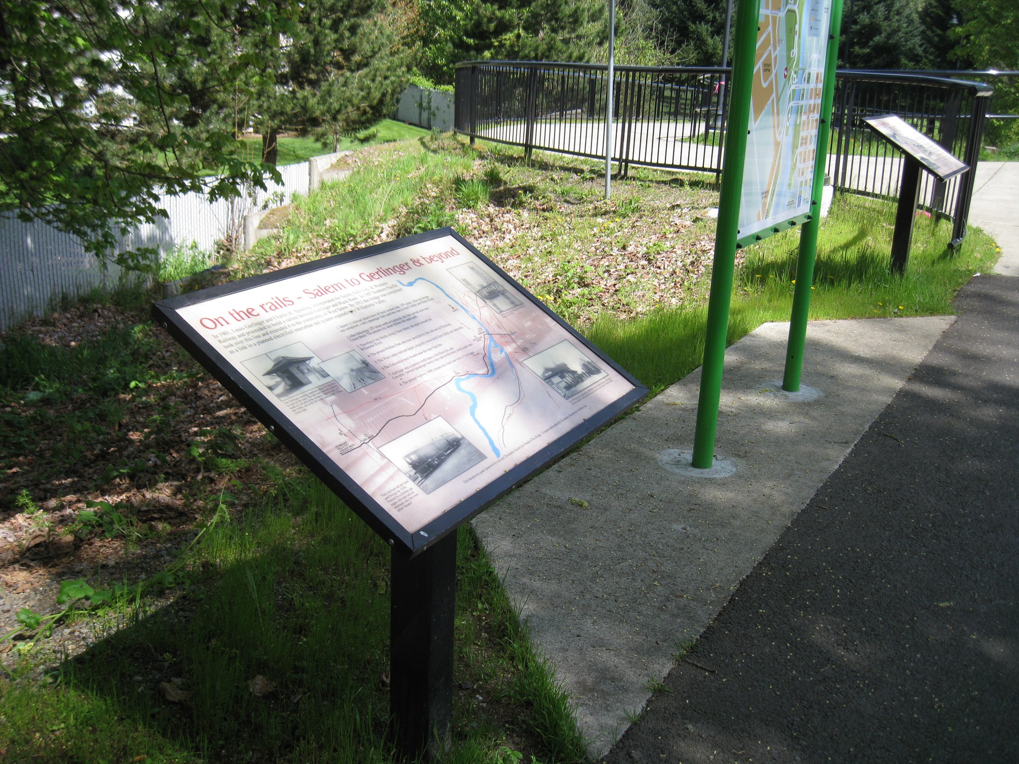
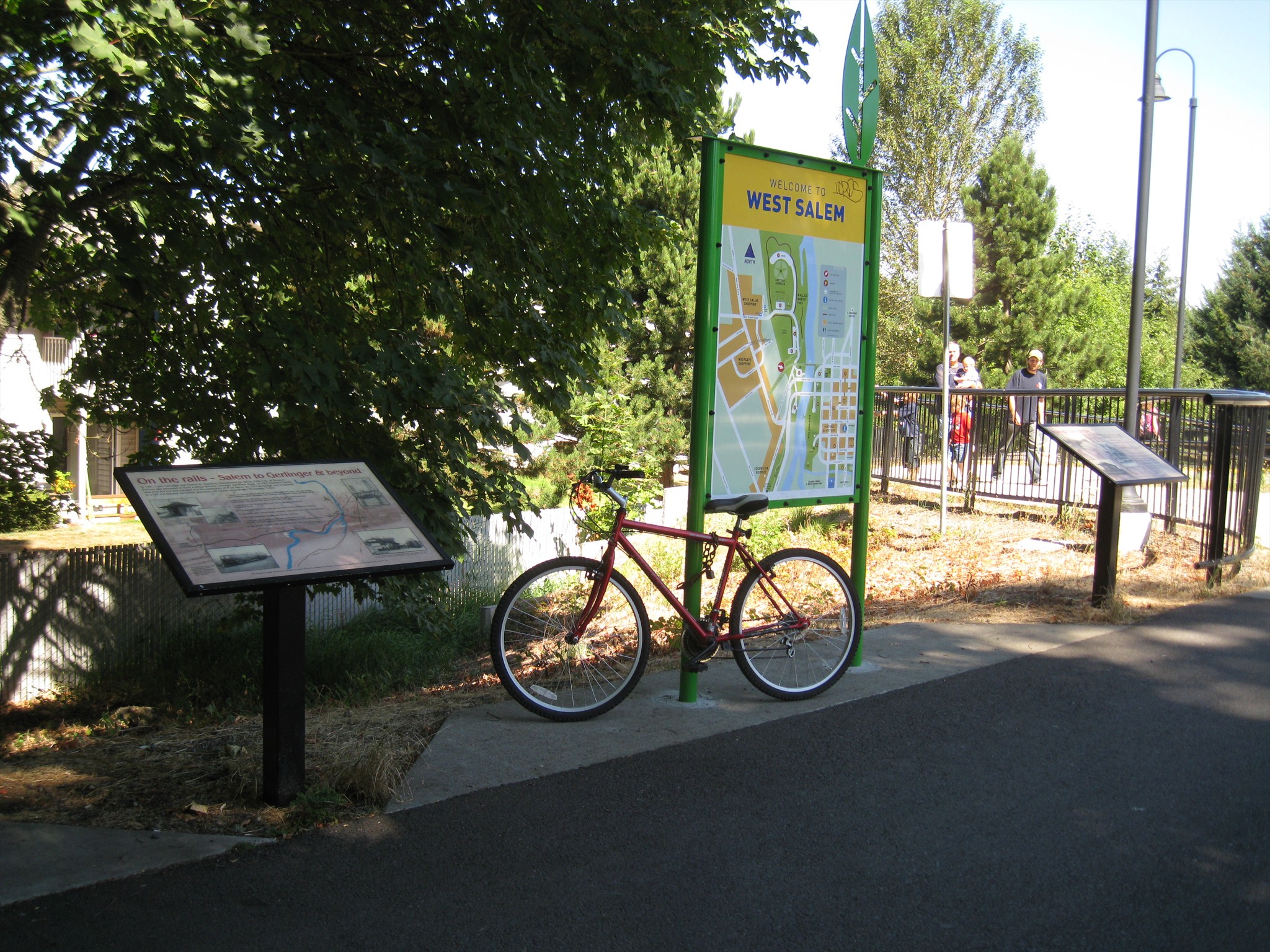
This history marker describes the development of the railroad line that once connected Salem to the communities to the west. It was placed at the west end of the bridge trestle in connection with the conversion of the
Union Street Bridge from an abandoned rail crossing to a pedestrian and bicycle path. The marker is adjacent to a "
You Are Here" map and another history marker. The marker text (with spelling and punctuation errors left intact) reads:
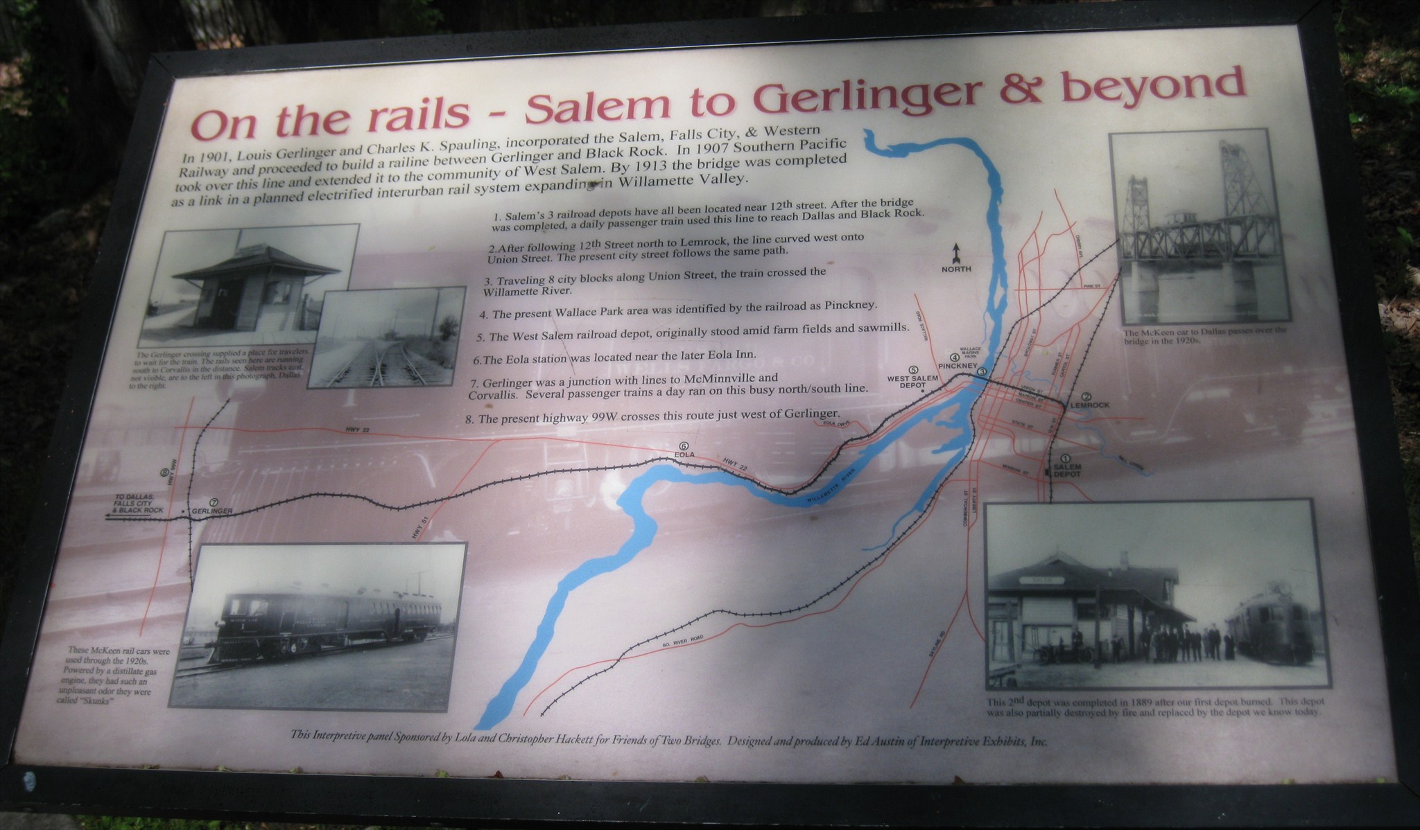
On the rails - Salem to Gerlinger & beyondIn 1901, Louis Gerlinger and Charles K. Spaulding, incorporated the Salem, Falls City, & Western Railway and proceeded to build a railine between Gerlinger and Black Rock. In 1907 Southern Pacific took over this line and extended it to the community of West Salem. By 1913 the bridge was completed as a link in a planned electrified interurban rail system expanding in Willamette Valley.
- Salem's 3 railroad depots have all been located near 12th street. After the bridge was completed, a daily passenger train used this line to reach Dallas and Black Rock.
- After following 12th Street north to Lemrock, the line curved west onto Union Street. The present city street follows the name path.
- Traveling 8 city blocks along Union Street, the train crossed the Willamette River.
- The present Wallace Park area was identified by the railroad as Pinckney.
- The West Salem railroad depot, originally stood amid farm fields and sawmills.
- The Eola station was located near the later Eola Inn.
- Gerlinger was a junction with lines to McMinnville and Corvallis. Several passenger trains a day ran on this busy north/south line.
- The present highway 99W crosses this route just west of Gerlinger.
Photo Captions:
- The Gerlinger crossing supplied a place for travelers to wait for the train. The rails seen here are running south to Corvallis in the distance. Salem tracks east, not visible, are left in this photograph, Dallas to the right.
- These McKeen rail cars were used through the 1920s. Powered by a distallate gas engine, they had such an unpleasant odor they were called "Skunks"
- The McKeen car to Dallas passes over the bridge in the 1920s.
- The 2nd depot was completed in 1889 after our first depot burned. This depot was also partially destroyed by fire and replaced by the depot we know today.
Click a photo to enlarge
Visit Instructions:
Include your thoughts and observations pertaining to this location and your visit. Provide any additional history that you are aware of that pertains to this location. If the marker commemorates a historic building tell us what it is used for now or share with us the circumstances of an earlier visit to bring this locations history to life.
Please upload a favorite photograph you took of the waymark. Although visiting this waymark in person is the only thing required of you to receive credit for your visit, taking the time to add this information is greatly appreciated.
Be creative.