Merganser 'T' Marker - Klamath Falls, OR
N 42° 11.161 W 121° 47.374
10T E 599954 N 4671139
This historical 'T' marker is located just off Hwy 140 at the end of Memorial Drive in Klamath Falls, Oregon.
Waymark Code: WMJA80
Location: Oregon, United States
Date Posted: 10/18/2013
Views: 5

This historical marker is part of a series of historical markers located all around Klamath County and placed by the local Klamath County Historical Society.
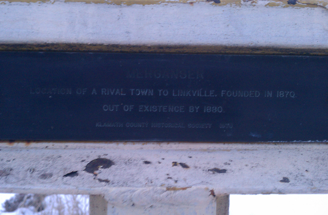
This particular T-marker marks the location of the first township to be established here in the area. There is another historical plaque near this T marker.
The marker text reads:
MERGANSER
LOCATION OF A RIVAL TOWN TO LINKVILLE. FOUNDED IN 1870.
OUT OF EXISTENCE BY 1880.
KLAMATH COUNTY HISTORICAL SOCIETY 1978
The name Merganser is derived from a type of duck that frequents this area as part its the migratory route, along with hundreds of other bird species, so it's not surprising that this former township inherited this bird's name. There are no longer any traces of this former township and only this historical marker and the nearby historical plaque remain.
Visit Instructions:
Include your thoughts and observations pertaining to this location and your visit. Provide any additional history that you are aware of that pertains to this location. If the marker commemorates a historic building tell us what it is used for now or share with us the circumstances of an earlier visit to bring this locations history to life.
Please upload a favorite photograph you took of the waymark. Although visiting this waymark in person is the only thing required of you to receive credit for your visit, taking the time to add this information is greatly appreciated.
Be creative.