
10-40 Hampton Plantation
Posted by:  mikemtn
N 33° 10.444 W 079° 25.040
17S E 647562 N 3671699
Located on Hwy 17 North of McClellanville South Carolina. Erected by the James-Santee Historical Society-2001.
Waymark Code: WMTXV
Location: South Carolina, United States
Date Posted: 10/11/2006
Views: 33
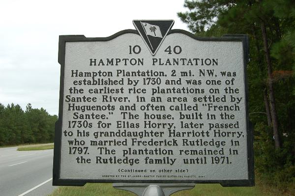
Text front: Hampton Plantation, 2 mi. N.W., was one of the earliest rice plantations on the Santee River, in an area settled by Huguenots and often called "French Santee." The house, built in the 1730's for Elias Horry, later passed to his granddaughter Harriott Horry, who married Frederick Rutledge in 1797. The plantation remained in the Rutledge family until 1971.
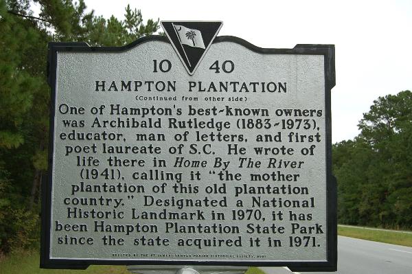
One of Hampton's best-known owners was Archibald Rutledge (1883-1973), educator, man of letters, and first poet laureate of S.C. He wrote of life there in Home by the River (1941), calling it "the mother plantation of this old plantation country." Designated a National Historic Landmark in 1970, it has been Hampton State Park since the state acquired it in 1971.
